Caloocan City night lights from space
Night Light of Caloocan City (Metro Manila) from space (Philippines) Src. Average luminocity for 10x10km area is 87.4589% and for 50x50km: 42.6777%.
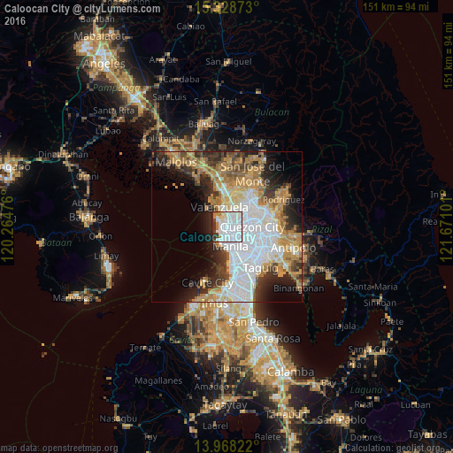
Analysis of Caloocan City night lights 2016
Square area 10x10 km:
 56.28%
90-99
17.97%80-89
4.33%70-79
2.81%60-69
5.41%50-59
0%40-49
1.95%30-39
6.93%20-29
4.33%10-19
0%0-9
0%Square area 50x50 km:
13.65%90-99
7.4%80-89
4.12%70-79
7.2%60-69
7.24%50-59
3.06%40-49
3.46%30-39
5.05%20-29
7.02%10-19
8.3%0-9
33.49%Clear (daylight) street map image can be seen on geolist.org.
Map coordinates:
15° 19' 43.4" North, 120° 15' 53.1" East
14° 38' 58.3" North, 120° 58' 4.4" East
13° 58' 5.6" North, 121° 40' 15.6" East
Some cities around Caloocan City sort by population:
• Manila
5.3 km =3.3 mi,  163°
163°
• Navotas
2.7 km =1.7 mi,  314°
314°
• Tanza
4.2 km =2.6 mi, 312°
• Obando
7.5 km =4.7 mi,  333°
333°
• Port Area
7.4 km =4.6 mi,  180°
180°
• Bagong Pagasa
7.1 km =4.4 mi,  78°
78°
• Quiapo
5.8 km =3.6 mi, 163°
• Del Monte
5.4 km =3.4 mi,  99°
99°
1720151 (p: 1,500,000)
Sources (retrieved 2019-11-25):
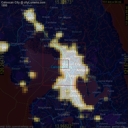
» NASA, Earths city lights 1995
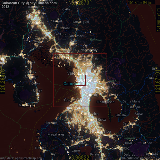
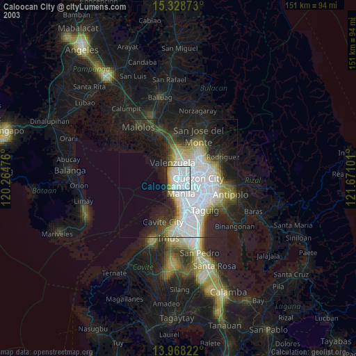
» NASA city lights 2003
» Earth at Night: Flat Maps 2012, 2016