Naga night lights from space
Night Light of Naga (Central Visayas) from space (Philippines) Src. Average luminocity for 10x10km area is 24.3884% and for 50x50km: 12.8975%.
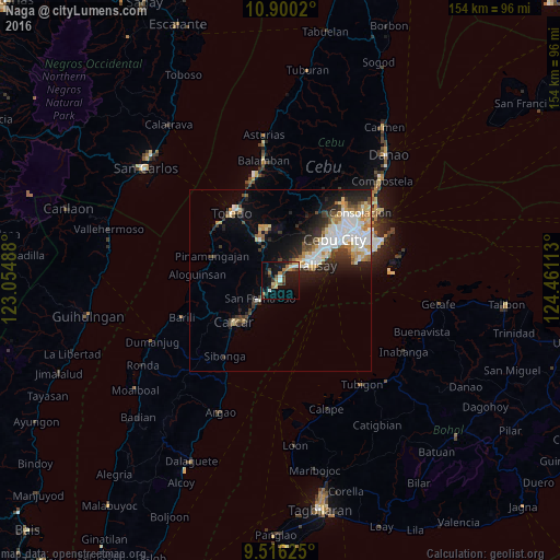
Analysis of Naga night lights 2016
Square area 10x10 km:
 2.89%
2.89%90-99
2.07%80-89
2.48%70-79
2.48%60-69
6.4%50-59
1.86%40-49
5.58%30-39
2.69%20-29
4.13%10-19
27.27%0-9
42.15%Square area 50x50 km:
2.71%90-99
2.62%80-89
1.51%70-79
1.31%60-69
1.68%50-59
0.86%40-49
1.72%30-39
1.69%20-29
3.32%10-19
5.68%0-9
76.91%Clear (daylight) street map image can be seen on geolist.org.
Map coordinates:
10° 54' 0.7" North, 123° 3' 17.6" East
10° 12' 32.3" North, 123° 45' 28.8" East
9° 30' 58.5" North, 124° 27' 40.1" East
Some cities around Naga sort by population:
• Talisay
10.8 km =6.7 mi,  68°
68°
• Minglanilla
5.8 km =3.6 mi,  46°
46°
• San Fernando
7.6 km =4.7 mi,  226°
226°
• Perrelos
13.8 km =8.6 mi,  221°
221°
• Jaclupan
12.1 km =7.5 mi,  31°
31°
• Can-asujan
14.1 km =8.8 mi, 231°
• Inayagan
3.1 km =1.9 mi,  22°
22°
• Langtad
3.7 km =2.3 mi, 224°
1698839 (p: 28,571)
Sources (retrieved 2019-11-25):
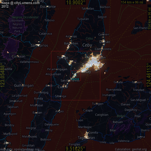
» Earth at Night: Flat Maps 2012, 2016