Simod night lights from space
Night Light of Simod (Davao) from space (Philippines) Src. Average luminocity for 10x10km area is 0% and for 50x50km: 0.0688%.
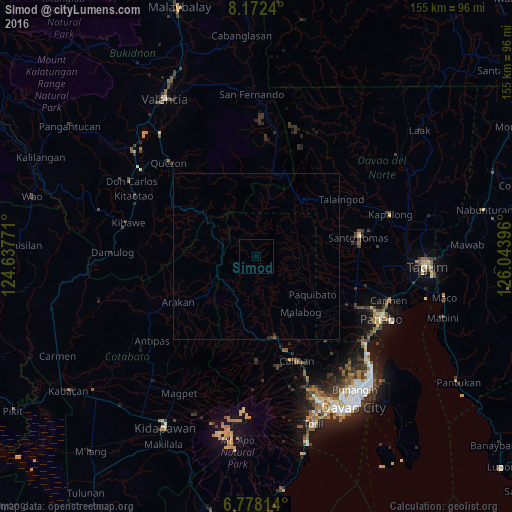
Analysis of Simod night lights 2016
Square area 10x10 km:
 0%
0%90-99
0%80-89
0%70-79
0%60-69
0%50-59
0%40-49
0%30-39
0%20-29
0%10-19
0%0-9
100%Square area 50x50 km:
0%90-99
0%80-89
0%70-79
0%60-69
0%50-59
0.03%40-49
0%30-39
0.04%20-29
0.09%10-19
0.03%0-9
99.8%Clear (daylight) street map image can be seen on geolist.org.
Map coordinates:
8° 10' 20.6" North, 124° 38' 15.8" East
7° 28' 33" North, 125° 20' 27" East
6° 46' 41.3" North, 126° 2' 38.3" East
Some cities around Simod sort by population:
• New Visayas
31.6 km =19.6 mi,  80°
80°
• Santo Niño
35.4 km =22 mi,  62°
62°
• Tamugan
27.5 km =17.1 mi,  171°
171°
• Alejal
36.6 km =22.7 mi,  106°
106°
• Tubod
35.5 km =22.1 mi, 109°
• Wañgan
37 km =23 mi,  161°
161°
• Salawagan
35.6 km =22.1 mi,  315°
315°
• La Libertad
33.8 km =21 mi,  89°
89°
1979271 (p: 5,068)
Sources (retrieved 2019-11-25):
» Earth at Night: Flat Maps 2012, 2016