Santo Rosario night lights from space
Night Light of Santo Rosario (Central Luzon) from space (Philippines) Src. Average luminocity for 10x10km area is 1.0584% and for 50x50km: 3.7243%.
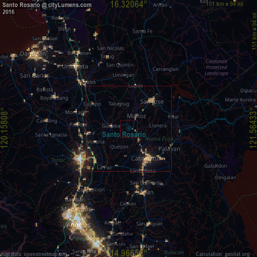
Analysis of Santo Rosario night lights 2016
Square area 10x10 km:
 0%
0%90-99
0%80-89
0%70-79
0%60-69
0%50-59
0.87%40-49
0%30-39
0.43%20-29
0.43%10-19
0.43%0-9
97.84%Square area 50x50 km:
0%90-99
0.07%80-89
0.28%70-79
0.92%60-69
0.77%50-59
0.56%40-49
0.88%30-39
0.85%20-29
0.91%10-19
3.09%0-9
91.67%Clear (daylight) street map image can be seen on geolist.org.
Map coordinates:
16° 19' 14.3" North, 120° 9' 29.1" East
15° 38' 40.9" North, 120° 51' 40.3" East
14° 57' 59.5" North, 121° 33' 51.6" East
Some cities around Santo Rosario sort by population:
• Talavera
8.8 km =5.5 mi,  135°
135°
• Muñoz
9.1 km =5.7 mi,  29°
29°
• Guimba
10.1 km =6.3 mi,  280°
280°
• Quezon
11.5 km =7.1 mi,  205°
205°
• Baloc
2.6 km =1.6 mi,  92°
92°
• Mabini
14 km =8.7 mi,  110°
110°
• Bibiclat
13.7 km =8.5 mi,  179°
179°
• Licab
15.3 km =9.5 mi,  223°
223°
1687564 (p: 6,234)
Sources (retrieved 2019-11-25):
» Earth at Night: Flat Maps 2012, 2016