Santa Monica night lights from space
Night Light of Santa Monica (Central Luzon) from space (Philippines) Src. Average luminocity for 10x10km area is 0.1667% and for 50x50km: 11.5976%.
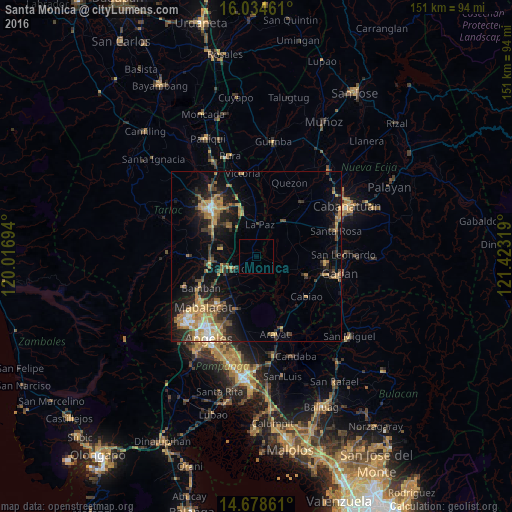
Analysis of Santa Monica night lights 2016
Square area 10x10 km:
 0%
0%90-99
0%80-89
0%70-79
0%60-69
0%50-59
0%40-49
0%30-39
0%20-29
0%10-19
0%0-9
100%Square area 50x50 km:
0.58%90-99
0.85%80-89
1.17%70-79
2.77%60-69
2.74%50-59
1.33%40-49
2.18%30-39
2.14%20-29
3.18%10-19
8.09%0-9
74.98%Clear (daylight) street map image can be seen on geolist.org.
Map coordinates:
16° 2' 4.6" North, 120° 1' 1" East
15° 21' 27.8" North, 120° 43' 12.2" East
14° 40' 43" North, 121° 25' 23.5" East
Some cities around Santa Monica sort by population:
• Capas
14.3 km =8.9 mi,  258°
258°
• Concepcion
7.6 km =4.7 mi,  241°
241°
• Papaya
13.1 km =8.1 mi,  108°
108°
• La Paz
9.3 km =5.8 mi,  5°
5°
• San Francisco
12.9 km =8 mi,  91°
91°
• San Vicente
10.1 km =6.3 mi,  223°
223°
• Mapalacsiao
10.7 km =6.6 mi,  317°
317°
• Murcia
13 km =8.1 mi,  293°
293°
1687976 (p: 5,475)
Sources (retrieved 2019-11-25):
» Earth at Night: Flat Maps 2012, 2016