Capas night lights from space
Night Light of Capas (Central Luzon) from space (Philippines) Src. Average luminocity for 10x10km area is 17.4524% and for 50x50km: 11.3696%.
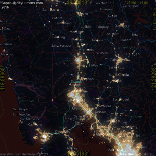
Analysis of Capas night lights 2016
Square area 10x10 km:
 0%
0%90-99
0%80-89
0.43%70-79
3.9%60-69
1.73%50-59
3.46%40-49
8.87%30-39
5.41%20-29
1.52%10-19
11.47%0-9
63.2%Square area 50x50 km:
0.63%90-99
0.97%80-89
1.15%70-79
2.73%60-69
2.85%50-59
1.29%40-49
2.07%30-39
1.99%20-29
3.13%10-19
7.64%0-9
75.57%Clear (daylight) street map image can be seen on geolist.org.
Map coordinates:
16° 0' 29.4" North, 119° 53' 12" East
15° 19' 52.2" North, 120° 35' 23.3" East
14° 39' 7.1" North, 121° 17' 34.5" East
Some cities around Capas sort by population:
• Mabalacat City
12.2 km =7.6 mi,  189°
189°
• Concepcion
7.3 km =4.5 mi,  95°
95°
• San Miguel
12.6 km =7.8 mi,  4°
4°
• San Vicente
8.2 km =5.1 mi,  121°
121°
• Santa Lucia
11.8 km =7.3 mi,  290°
290°
• Santa Monica
14.3 km =8.9 mi,  78°
78°
• Mapalacsiao
12.7 km =7.9 mi,  31°
31°
• Murcia
8.4 km =5.2 mi,  14°
14°
1718722 (p: 72,070)
Sources (retrieved 2019-11-25):
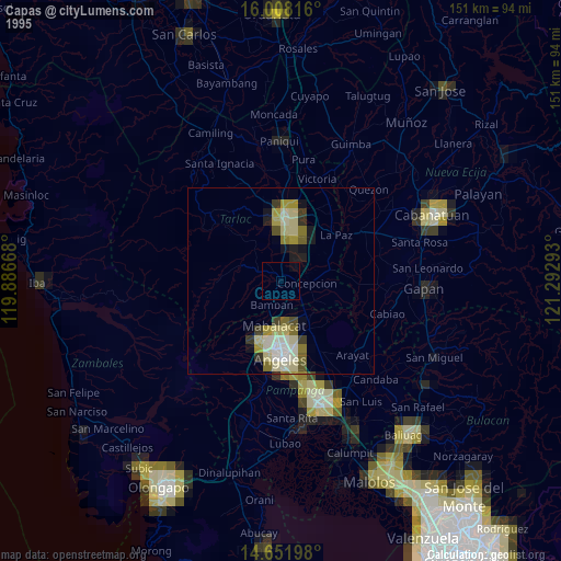
» NASA, Earths city lights 1995
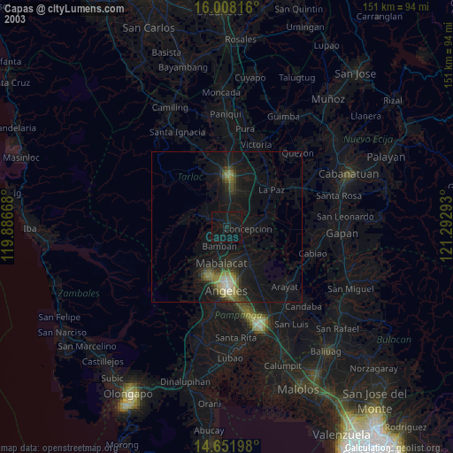
» NASA city lights 2003
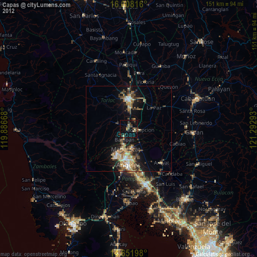
» Earth at Night: Flat Maps 2012, 2016