Pulong Santa Cruz night lights from space
Night Light of Pulong Santa Cruz (Calabarzon) from space (Philippines) Src. Average luminocity for 10x10km area is 85.8225% and for 50x50km: 36.5125%.
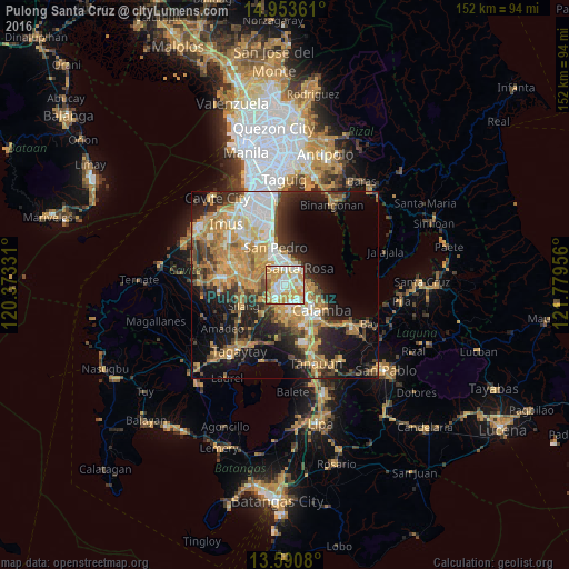
Analysis of Pulong Santa Cruz night lights 2016
Square area 10x10 km:
 18.61%
90-99
27.49%80-89
14.94%70-79
30.52%60-69
5.41%50-59
2.81%40-49
0%30-39
0.22%20-29
0%10-19
0%0-9
0%Square area 50x50 km:
4.48%90-99
5.8%80-89
4.43%70-79
10.22%60-69
7.18%50-59
3.19%40-49
4.73%30-39
4.95%20-29
8.06%10-19
14.19%0-9
32.78%Clear (daylight) street map image can be seen on geolist.org.
Map coordinates:
14° 57' 13" North, 120° 22' 23.9" East
14° 16' 23.7" North, 121° 4' 35.1" East
13° 35' 26.9" North, 121° 46' 46.4" East
Some cities around Pulong Santa Cruz sort by population:
• Cabuyao
5.4 km =3.4 mi,  90°
90°
• Biñan
7.7 km =4.8 mi,  3°
3°
• San Pedro
10.1 km =6.3 mi,  341°
341°
• Santa Rosa
5.7 km =3.5 mi,  40°
40°
• Carmona
4.9 km =3 mi, 335°
• Mamatid
9.9 km =6.2 mi,  115°
115°
• Bulihan
8.8 km =5.5 mi,  273°
273°
• Maguyam
7.8 km =4.8 mi,  261°
261°
1692520 (p: 101,914)
Sources (retrieved 2019-11-25):
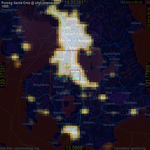
» NASA, Earths city lights 1995
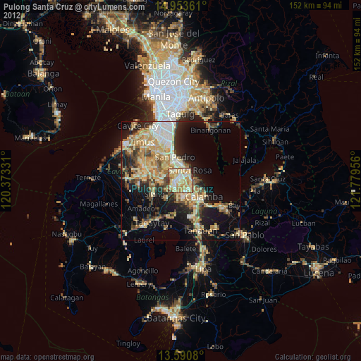
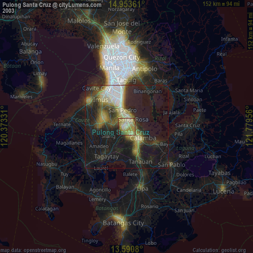
» NASA city lights 2003
» Earth at Night: Flat Maps 2012, 2016