Santa Rosa night lights from space
Night Light of Santa Rosa (Calabarzon) from space (Philippines) Src. Average luminocity for 10x10km area is 62.3788% and for 50x50km: 37.3493%.
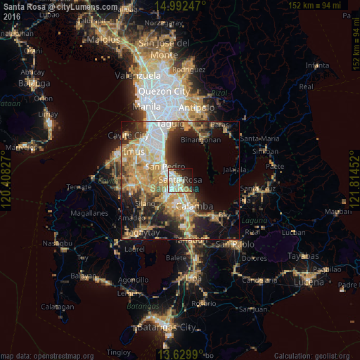
Analysis of Santa Rosa night lights 2016
Square area 10x10 km:
 14.5%
14.5%90-99
21%80-89
8.87%70-79
9.52%60-69
7.14%50-59
0.87%40-49
0.87%30-39
4.33%20-29
16.45%10-19
12.12%0-9
4.33%Square area 50x50 km:
5.57%90-99
6.22%80-89
4.36%70-79
9.97%60-69
7.21%50-59
3.02%40-49
4.51%30-39
5.31%20-29
7.74%10-19
12.66%0-9
33.44%Clear (daylight) street map image can be seen on geolist.org.
Map coordinates:
14° 59' 32.9" North, 120° 24' 29.8" East
14° 18' 44" North, 121° 6' 41" East
13° 37' 47.6" North, 121° 48' 52.3" East
Some cities around Santa Rosa sort by population:
• Calamba
12.6 km =7.8 mi,  152°
152°
• Cabuyao
4.7 km =2.9 mi,  160°
160°
• Biñan
4.7 km =2.9 mi,  315°
315°
• San Pedro
8.7 km =5.4 mi,  307°
307°
• Pulong Santa Cruz
5.7 km =3.5 mi,  220°
220°
• Carmona
5.8 km =3.6 mi,  271°
271°
• Mamatid
10 km =6.2 mi, 149°
• Gulod
12 km =7.5 mi,  72°
72°
1687894 (p: 216,650)
Sources (retrieved 2019-11-25):
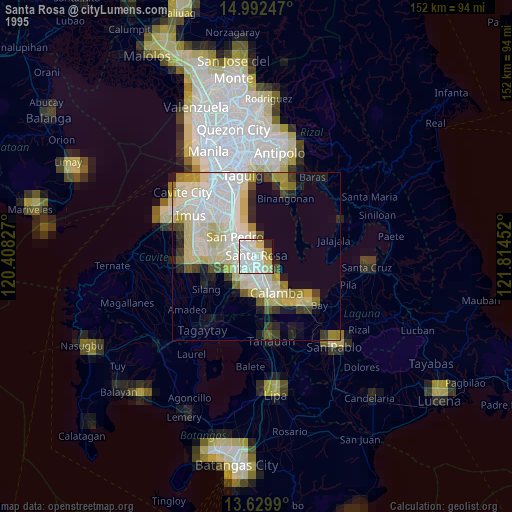
» NASA, Earths city lights 1995
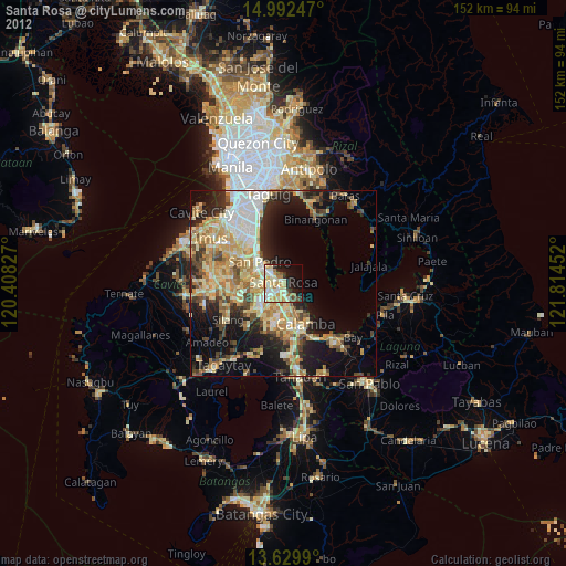
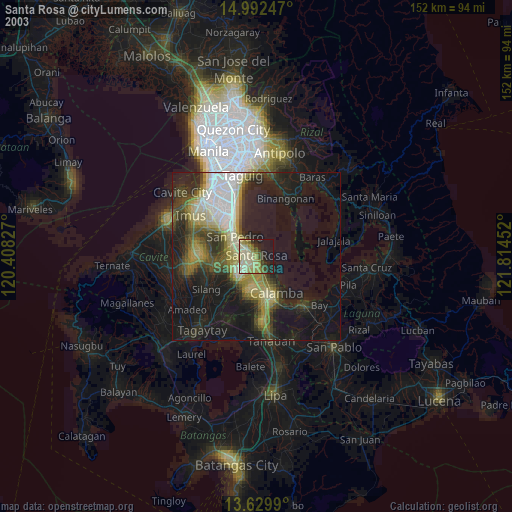
» NASA city lights 2003
» Earth at Night: Flat Maps 2012, 2016