Bulihan night lights from space
Night Light of Bulihan (Calabarzon) from space (Philippines) Src. Average luminocity for 10x10km area is 63.6602% and for 50x50km: 36.2529%.
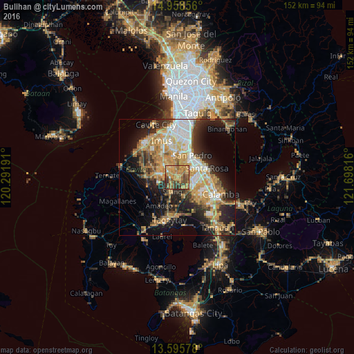
Analysis of Bulihan night lights 2016
Square area 10x10 km:
 1.08%
1.08%90-99
1.52%80-89
8.87%70-79
33.77%60-69
21.86%50-59
10.82%40-49
12.55%30-39
6.49%20-29
3.03%10-19
0%0-9
0%Square area 50x50 km:
4.57%90-99
5.82%80-89
4.39%70-79
10.16%60-69
6.98%50-59
3.25%40-49
4.57%30-39
4.79%20-29
8.23%10-19
14.3%0-9
32.94%Clear (daylight) street map image can be seen on geolist.org.
Map coordinates:
14° 57' 30.8" North, 120° 17' 30.9" East
14° 16' 41.5" North, 120° 59' 42.1" East
13° 35' 44.8" North, 121° 41' 53.4" East
Some cities around Bulihan sort by population:
• Dasmariñas
8.5 km =5.3 mi,  312°
312°
• San Pedro
10.7 km =6.6 mi,  31°
31°
• Silang
7.4 km =4.6 mi,  200°
200°
• Pulong Santa Cruz
8.8 km =5.5 mi,  93°
93°
• Carmona
7.8 km =4.8 mi,  60°
60°
• Manggahan
10.2 km =6.3 mi,  278°
278°
• Balite Segundo
10.8 km =6.7 mi,  191°
191°
• Maguyam
2 km =1.2 mi,  147°
147°
1966063 (p: 13,979)
Sources (retrieved 2019-11-25):
» Earth at Night: Flat Maps 2012, 2016