Samal night lights from space
Night Light of Samal (Davao) from space (Philippines) Src. Average luminocity for 10x10km area is 4.8745% and for 50x50km: 10.0813%.
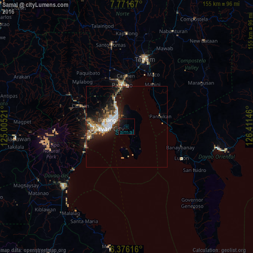
Analysis of Samal night lights 2016
Square area 10x10 km:
100  0%
0%
90-99 0%
80-89 0%
70-79 0%
60-69 0%
50-59 0%
40-49 1.3%
30-39 3.03%
20-29 1.3%
10-19 13.2%
0-9 81.17%
0%90-99
0%80-89
0%70-79
0%60-69
0%50-59
0%40-49
1.3%30-39
3.03%20-29
1.3%10-19
13.2%0-9
81.17%Square area 50x50 km:
100 2.03%
90-99 1.63%
80-89 0.87%
70-79 1%
60-69 1.43%
50-59 1.33%
40-49 1.19%
30-39 1.82%
20-29 3.16%
10-19 6.36%
0-9 79.18%
2.03%90-99
1.63%80-89
0.87%70-79
1%60-69
1.43%50-59
1.33%40-49
1.19%30-39
1.82%20-29
3.16%10-19
6.36%0-9
79.18%Clear (daylight) street map image can be seen on geolist.org.
Map coordinates:
7° 46' 18" North, 125° 0' 18.8" East
7° 4' 28" North, 125° 42' 30" East
6° 22' 34.2" North, 126° 24' 41.3" East
Some cities around Samal sort by population:
• Davao
10.5 km =6.5 mi,  269°
269°
• Panabo
26.1 km =16.2 mi,  354°
354°
• Biao
22.9 km =14.2 mi,  295°
295°
• Lasang
21.9 km =13.6 mi, 347°
• Magnaga
23 km =14.3 mi,  62°
62°
• Inawayan
28.8 km =17.9 mi,  244°
244°
• Pandasan
28.3 km =17.6 mi,  34°
34°
• Bato
26.2 km =16.3 mi,  262°
262°
1690666 (p: 43,526)
Sources (retrieved 2019-11-25):
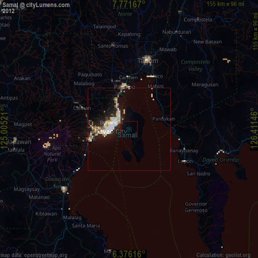
» Earth at Night: Flat Maps 2012, 2016