Magnaga night lights from space
Night Light of Magnaga (Davao) from space (Philippines) Src. Average luminocity for 10x10km area is 1.1147% and for 50x50km: 1.7768%.
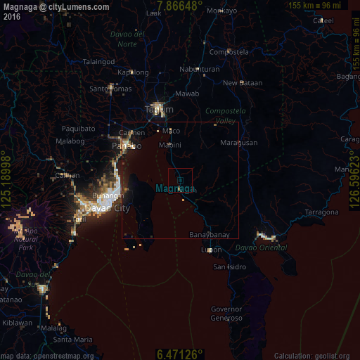
Analysis of Magnaga night lights 2016
Square area 10x10 km:
 0%
0%90-99
0%80-89
0%70-79
0.22%60-69
0.65%50-59
0%40-49
0%30-39
1.3%20-29
0%10-19
0%0-9
97.84%Square area 50x50 km:
0.1%90-99
0.12%80-89
0.2%70-79
0.22%60-69
0.22%50-59
0.24%40-49
0.23%30-39
0.35%20-29
0.49%10-19
2.25%0-9
95.56%Clear (daylight) street map image can be seen on geolist.org.
Map coordinates:
7° 51' 59.3" North, 125° 11' 23.9" East
7° 10' 9.8" North, 125° 53' 35.2" East
6° 28' 16.5" North, 126° 35' 46.4" East
Some cities around Magnaga sort by population:
• Panabo
27.7 km =17.2 mi,  303°
303°
• Samal
23 km =14.3 mi,  242°
242°
• Maco
21.8 km =13.5 mi,  348°
348°
• Carmen
29.6 km =18.4 mi,  315°
315°
• Corocotan
28.9 km =18 mi,  332°
332°
• Lasang
27.4 km =17 mi,  293°
293°
• Cuambog
16.3 km =10.1 mi,  342°
342°
• Pandasan
13.4 km =8.3 mi, 341°
1703833 (p: 7,644)
Sources (retrieved 2019-11-25):
» Earth at Night: Flat Maps 2012, 2016