Biao night lights from space
Night Light of Biao (Davao) from space (Philippines) Src. Average luminocity for 10x10km area is 8.9589% and for 50x50km: 12.5678%.
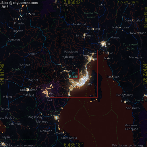
Analysis of Biao night lights 2016
Square area 10x10 km:
100  0%
0%
90-99 0%
80-89 0%
70-79 0%
60-69 0.87%
50-59 1.73%
40-49 0%
30-39 2.16%
20-29 7.79%
10-19 20.56%
0-9 66.88%
0%90-99
0%80-89
0%70-79
0%60-69
0.87%50-59
1.73%40-49
0%30-39
2.16%20-29
7.79%10-19
20.56%0-9
66.88%Square area 50x50 km:
100 2.14%
90-99 1.71%
80-89 1.11%
70-79 1.25%
60-69 1.75%
50-59 1.9%
40-49 1.64%
30-39 2.38%
20-29 4.02%
10-19 8.74%
0-9 73.36%
2.14%90-99
1.71%80-89
1.11%70-79
1.25%60-69
1.75%50-59
1.9%40-49
1.64%30-39
2.38%20-29
4.02%10-19
8.74%0-9
73.36%Clear (daylight) street map image can be seen on geolist.org.
Map coordinates:
7° 51' 37.5" North, 124° 49' 4.8" East
7° 9' 48" North, 125° 31' 16" East
6° 27' 54.6" North, 126° 13' 27.3" East
Some cities around Biao sort by population:
• Davao
14.2 km =8.8 mi,  134°
134°
• Samal
22.9 km =14.2 mi,  115°
115°
• Lasang
19.6 km =12.2 mi,  54°
54°
• Tamugan
17.6 km =10.9 mi,  295°
295°
• Wañgan
8.4 km =5.2 mi,  267°
267°
• Tamayong
16 km =9.9 mi,  257°
257°
• Bato
14.4 km =8.9 mi,  201°
201°
• Sirib
13 km =8.1 mi, 255°
1725486 (p: 12,043)
Sources (retrieved 2019-11-25):
» Earth at Night: Flat Maps 2012, 2016