Pulilan night lights from space
Night Light of Pulilan (Central Luzon) from space (Philippines) Src. Average luminocity for 10x10km area is 46.9298% and for 50x50km: 24.8009%.
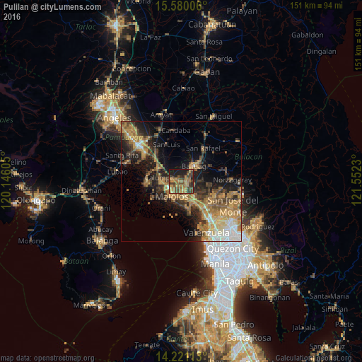
Analysis of Pulilan night lights 2016
Square area 10x10 km:
 0%
0%90-99
0%80-89
3.93%70-79
17.36%60-69
18.39%50-59
5.79%40-49
16.12%30-39
10.95%20-29
9.71%10-19
17.77%0-9
0%Square area 50x50 km:
1.88%90-99
2.65%80-89
2.57%70-79
6.3%60-69
6.74%50-59
2.99%40-49
4.41%30-39
4.53%20-29
6.48%10-19
11.47%0-9
49.97%Clear (daylight) street map image can be seen on geolist.org.
Map coordinates:
15° 34' 48.2" North, 120° 8' 45.8" East
14° 54' 6" North, 120° 50' 57" East
14° 13' 16.1" North, 121° 33' 8.3" East
Some cities around Pulilan sort by population:
• Malolos
7.6 km =4.7 mi,  213°
213°
• Baliuag
7.8 km =4.8 mi,  41°
41°
• Calumpit
9.1 km =5.7 mi,  280°
280°
• Guiguinto
8.4 km =5.2 mi,  154°
154°
• Plaridel
1.8 km =1.1 mi, 151°
• Balagtas
9.6 km =6 mi,  168°
168°
• Balucuc
6.8 km =4.2 mi,  326°
326°
• Culianin
5.5 km =3.4 mi,  74°
74°
1692565 (p: 77,186)
Sources (retrieved 2019-11-25):
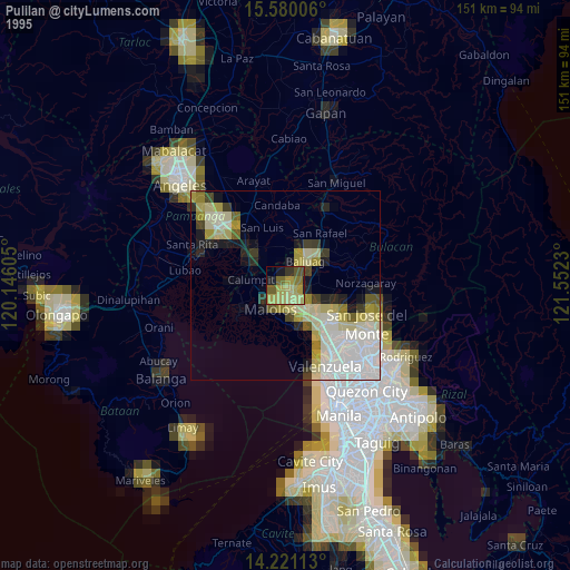
» NASA, Earths city lights 1995
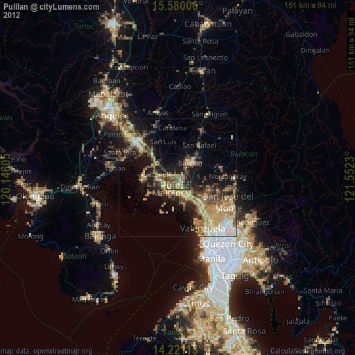
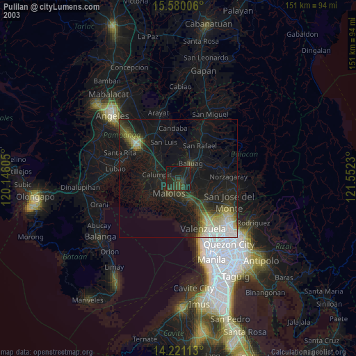
» NASA city lights 2003
» Earth at Night: Flat Maps 2012, 2016