Plaridel night lights from space
Night Light of Plaridel (Central Luzon) from space (Philippines) Src. Average luminocity for 10x10km area is 50.8616% and for 50x50km: 25.852%.
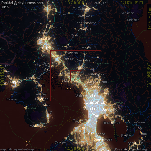

Analysis of Plaridel night lights 2016
Square area 10x10 km:
 0%
0%90-99
0%80-89
5.17%70-79
16.32%60-69
23.14%50-59
8.26%40-49
16.12%30-39
10.33%20-29
12.6%10-19
8.06%0-9
0%Square area 50x50 km:
2.49%90-99
3.03%80-89
2.65%70-79
6.32%60-69
6.75%50-59
3.06%40-49
4.39%30-39
4.51%20-29
6.47%10-19
11.28%0-9
49.04%Clear (daylight) street map image can be seen on geolist.org.
Map coordinates:
15° 33' 56.4" North, 120° 9' 14.8" East
14° 53' 14" North, 120° 51' 26" East
14° 12' 23.9" North, 121° 33' 37.3" East
Some cities around Plaridel sort by population:
• Malolos
6.9 km =4.3 mi,  226°
226°
• Baliuag
8.6 km =5.3 mi,  29°
29°
• Pulilan
1.8 km =1.1 mi,  331°
331°
• Guiguinto
6.6 km =4.1 mi,  154°
154°
• Balagtas
7.9 km =4.9 mi,  172°
172°
• Paombong
9.6 km =6 mi, 229°
• Balucuc
8.6 km =5.3 mi, 327°
• Culianin
5.4 km =3.4 mi,  55°
55°
1693239 (p: 70,781)
Sources (retrieved 2019-11-25):
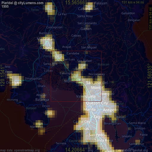
» NASA, Earths city lights 1995
» NASA city lights 2003
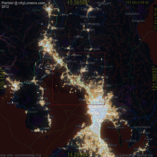
» Earth at Night: Flat Maps 2012, 2016