Guiguinto night lights from space
Night Light of Guiguinto (Central Luzon) from space (Philippines) Src. Average luminocity for 10x10km area is 50.6488% and for 50x50km: 29.5627%.
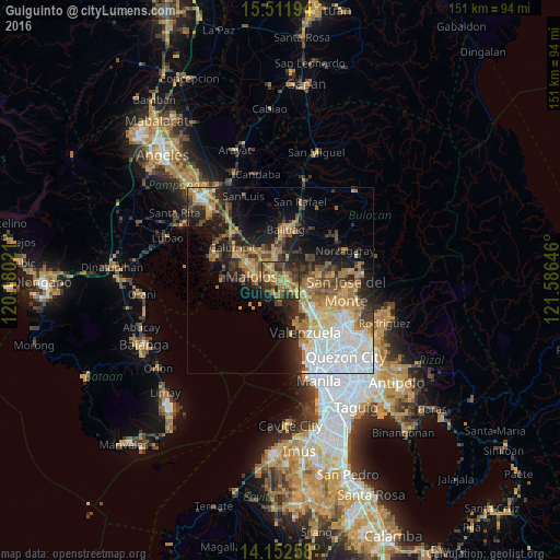
Analysis of Guiguinto night lights 2016
Square area 10x10 km:
 0%
0%90-99
0.21%80-89
5.37%70-79
16.74%60-69
19.83%50-59
9.3%40-49
13.02%30-39
16.32%20-29
15.08%10-19
4.13%0-9
0%Square area 50x50 km:
6.33%90-99
3.93%80-89
2.71%70-79
5.8%60-69
6.18%50-59
3%40-49
4.04%30-39
4.41%20-29
6.28%10-19
11.25%0-9
46.06%Clear (daylight) street map image can be seen on geolist.org.
Map coordinates:
15° 30' 43" North, 120° 10' 48.8" East
14° 49' 60" North, 120° 52' 60" East
14° 9' 9.3" North, 121° 35' 11.3" East
Some cities around Guiguinto sort by population:
• Malolos
7.9 km =4.9 mi,  278°
278°
• Bocaue
6 km =3.7 mi,  130°
130°
• Pulilan
8.4 km =5.2 mi,  334°
334°
• Bulacan
4.5 km =2.8 mi,  186°
186°
• Plaridel
6.6 km =4.1 mi, 334°
• Balagtas
2.6 km =1.6 mi,  224°
224°
• Pandi
8.7 km =5.4 mi,  66°
66°
• Sulucan
6.3 km =3.9 mi, 133°
1712531 (p: 76,613)
Sources (retrieved 2019-11-25):
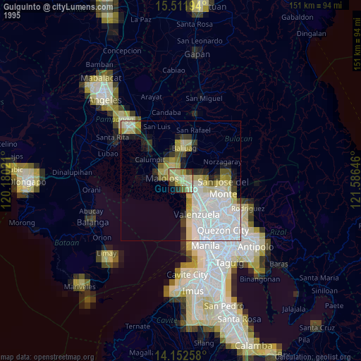
» NASA, Earths city lights 1995
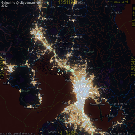
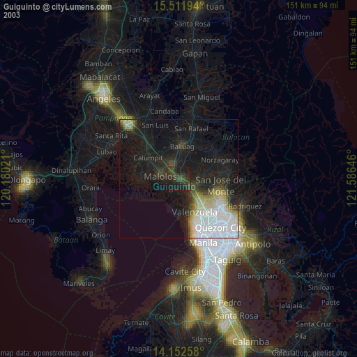
» NASA city lights 2003
» Earth at Night: Flat Maps 2012, 2016