Pasuquin night lights from space
Night Light of Pasuquin (Ilocos) from space (Philippines) Src. Average luminocity for 10x10km area is 0.405% and for 50x50km: 1.647%.
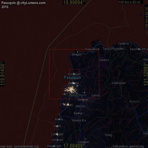
Analysis of Pasuquin night lights 2016
Square area 10x10 km:
 0%
0%90-99
0%80-89
0%70-79
0%60-69
0%50-59
0%40-49
0.83%30-39
0%20-29
0%10-19
0%0-9
99.17%Square area 50x50 km:
0.05%90-99
0.03%80-89
0.4%70-79
0.37%60-69
0.09%50-59
0.19%40-49
0.32%30-39
0.37%20-29
0.21%10-19
1.49%0-9
96.47%Clear (daylight) street map image can be seen on geolist.org.
Map coordinates:
18° 59' 56.2" North, 119° 54' 52.5" East
18° 19' 58.1" North, 120° 37' 3.7" East
17° 39' 50.7" North, 121° 19' 15" East
Some cities around Pasuquin sort by population:
• Laoag
15.2 km =9.4 mi,  188°
188°
• Batac City
31.3 km =19.4 mi, 190°
• San Nicolas
18 km =11.2 mi, 187°
• Claveria
57.8 km =35.9 mi,  58°
58°
• Bacarra
8.9 km =5.5 mi,  183°
183°
• Dingras
26.9 km =16.7 mi,  161°
161°
• Sarrat
19.7 km =12.2 mi,  170°
170°
• Vintar
12 km =7.5 mi, 164°
1694484 (p: 5,768)
Sources (retrieved 2019-11-25):
» Earth at Night: Flat Maps 2012, 2016