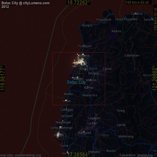
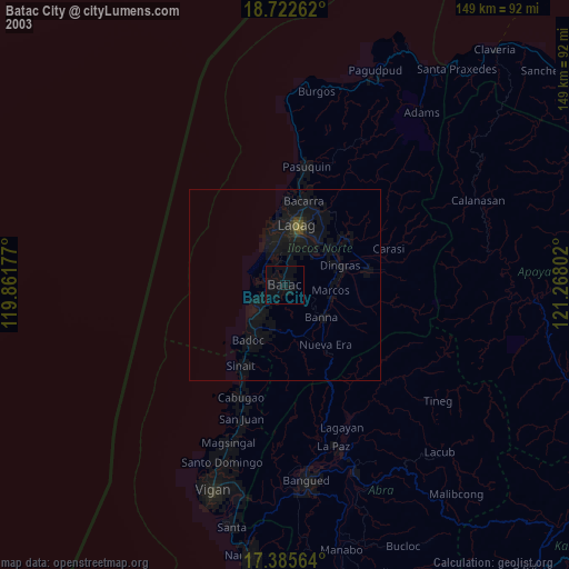
Batac City night lights from space
Night Light of Batac City (Ilocos) from space (Philippines) Src. Average luminocity for 10x10km area is 4.7987% and for 50x50km: 1.9594%.


Analysis of Batac City night lights 2016
Square area 10x10 km:
 0%
0%90-99
0%80-89
1.73%70-79
0%60-69
1.52%50-59
0.22%40-49
2.6%30-39
0.22%20-29
0.65%10-19
1.73%0-9
91.34%Square area 50x50 km:
0.05%90-99
0.03%80-89
0.5%70-79
0.34%60-69
0.17%50-59
0.23%40-49
0.47%30-39
0.39%20-29
0.38%10-19
1.63%0-9
95.81%Clear (daylight) street map image can be seen on geolist.org.
Map coordinates:
18° 43' 21.4" North, 119° 51' 42.4" East
18° 3' 19.4" North, 120° 33' 53.6" East
17° 23' 8.3" North, 121° 16' 4.9" East
Some cities around Batac City sort by population:
• Laoag
16.2 km =10.1 mi,  11°
11°
• San Nicolas
13.4 km =8.3 mi, 13°
• Bacarra
22.5 km =14 mi, 12°
• Cabugao
31.3 km =19.4 mi,  201°
201°
• Dingras
14.9 km =9.3 mi,  69°
69°
• Sarrat
14.3 km =8.9 mi,  37°
37°
• Pasuquin
31.3 km =19.4 mi, 10°
• Vintar
21.1 km =13.1 mi,  24°
24°
1726339 (p: 53,542)
Sources (retrieved 2019-11-25):
» NASA, Earths city lights 1995
» NASA city lights 2003
» Earth at Night: Flat Maps 2012, 2016