Lipa City night lights from space
Night Light of Lipa City (Calabarzon) from space (Philippines) Src. Average luminocity for 10x10km area is 38.25% and for 50x50km: 15.5216%.

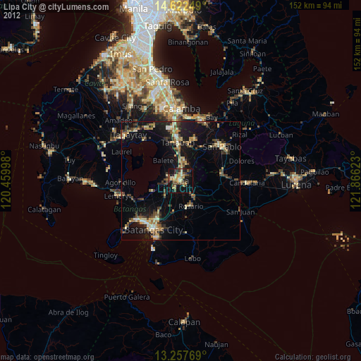
Analysis of Lipa City night lights 2016
Square area 10x10 km:
 0.83%
0.83%90-99
1.65%80-89
2.07%70-79
12.19%60-69
11.16%50-59
4.75%40-49
9.92%30-39
9.09%20-29
10.33%10-19
36.16%0-9
1.86%Square area 50x50 km:
0.64%90-99
0.74%80-89
0.99%70-79
4.3%60-69
3.31%50-59
1.46%40-49
3.28%30-39
3.48%20-29
4.41%10-19
14.29%0-9
63.12%Clear (daylight) street map image can be seen on geolist.org.
Map coordinates:
14° 37' 21" North, 120° 27' 35.9" East
13° 56' 28" North, 121° 9' 47.2" East
13° 15' 27.7" North, 121° 51' 58.4" East
Some cities around Lipa City sort by population:
• Banaybanay
10.9 km =6.8 mi,  158°
158°
• Malvar
11.5 km =7.1 mi,  357°
357°
• Balete
11.4 km =7.1 mi,  320°
320°
• Banaybanay
5.3 km =3.3 mi,  260°
260°
• Bulacnin
6.1 km =3.8 mi,  334°
334°
• Quilo-quilo
10.6 km =6.6 mi,  144°
144°
• Pansol
10.6 km =6.6 mi,  125°
125°
• Taysan
10.7 km =6.6 mi,  221°
221°
1706090 (p: 212,287)
Sources (retrieved 2019-11-25):
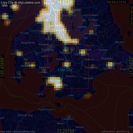
» NASA, Earths city lights 1995
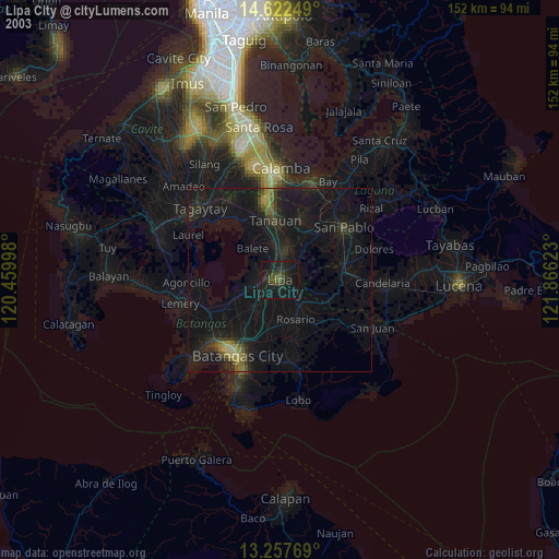
» NASA city lights 2003
» Earth at Night: Flat Maps 2012, 2016