Quilo-quilo night lights from space
Night Light of Quilo-quilo (Calabarzon) from space (Philippines) Src. Average luminocity for 10x10km area is 13.1116% and for 50x50km: 11.0788%.
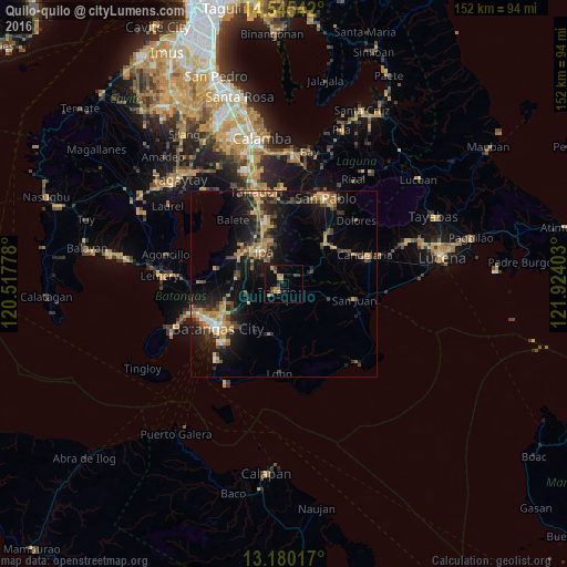
Analysis of Quilo-quilo night lights 2016
Square area 10x10 km:
 0%
0%90-99
0%80-89
0.41%70-79
6.2%60-69
2.48%50-59
0%40-49
3.72%30-39
2.89%20-29
0.41%10-19
10.12%0-9
73.76%Square area 50x50 km:
0.5%90-99
0.63%80-89
0.62%70-79
3.2%60-69
2.2%50-59
1.06%40-49
2.17%30-39
2.62%20-29
2.89%10-19
9.38%0-9
74.74%Clear (daylight) street map image can be seen on geolist.org.
Map coordinates:
14° 32' 43.5" North, 120° 31' 4" East
13° 51' 49.7" North, 121° 13' 15.2" East
13° 10' 48.6" North, 121° 55' 26.5" East
Some cities around Quilo-quilo sort by population:
• Lipa City
10.6 km =6.6 mi,  324°
324°
• Banaybanay
2.7 km =1.7 mi,  235°
235°
• Ibaan
10.8 km =6.7 mi, 241°
• Banaybanay
13.8 km =8.6 mi,  304°
304°
• Pansol
3.5 km =2.2 mi,  43°
43°
• Santa Catalina Norte
14.8 km =9.2 mi,  86°
86°
• Taysan
13.4 km =8.3 mi,  272°
272°
• Tiaong
15.5 km =9.6 mi, 44°
1692136 (p: 7,126)
Sources (retrieved 2019-11-25):
» Earth at Night: Flat Maps 2012, 2016