Bulacnin night lights from space
Night Light of Bulacnin (Calabarzon) from space (Philippines) Src. Average luminocity for 10x10km area is 36.7965% and for 50x50km: 18.3713%.
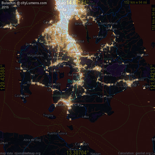
Analysis of Bulacnin night lights 2016
Square area 10x10 km:
 1.73%
1.73%90-99
2.6%80-89
1.3%70-79
15.15%60-69
9.09%50-59
2.38%40-49
8.01%30-39
5.19%20-29
12.34%10-19
27.06%0-9
15.15%Square area 50x50 km:
0.66%90-99
1.05%80-89
1.34%70-79
5.2%60-69
3.92%50-59
2%40-49
3.92%30-39
3.89%20-29
5.11%10-19
15.86%0-9
57.04%Clear (daylight) street map image can be seen on geolist.org.
Map coordinates:
14° 40' 17.5" North, 120° 26' 9.2" East
13° 59' 25.1" North, 121° 8' 20.4" East
13° 18' 25.3" North, 121° 50' 31.7" East
Some cities around Bulacnin sort by population:
• Lipa City
6.1 km =3.8 mi,  154°
154°
• Tanauan
10.7 km =6.6 mi,  6°
6°
• Malvar
6.4 km =4 mi,  19°
19°
• Balete
5.8 km =3.6 mi,  304°
304°
• Banaybanay
6.9 km =4.3 mi,  202°
202°
• Balele
9.7 km =6 mi,  329°
329°
• San Andres
10.7 km =6.6 mi,  51°
51°
• Janopol
11.6 km =7.2 mi,  335°
335°
1723055 (p: 7,985)
Sources (retrieved 2019-11-25):
» Earth at Night: Flat Maps 2012, 2016