Hermosa night lights from space
Night Light of Hermosa (Central Luzon) from space (Philippines) Src. Average luminocity for 10x10km area is 18.9731% and for 50x50km: 8.3581%.
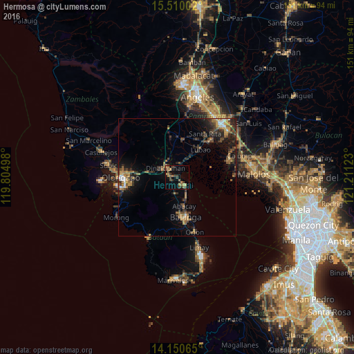
Analysis of Hermosa night lights 2016
Square area 10x10 km:
100  0%
0%
90-99 0%
80-89 1.65%
70-79 5.79%
60-69 3.31%
50-59 3.1%
40-49 6.4%
30-39 5.17%
20-29 1.65%
10-19 7.64%
0-9 65.29%
0%90-99
0%80-89
1.65%70-79
5.79%60-69
3.31%50-59
3.1%40-49
6.4%30-39
5.17%20-29
1.65%10-19
7.64%0-9
65.29%Square area 50x50 km:
100 0.44%
90-99 0.5%
80-89 0.41%
70-79 1.77%
60-69 1.71%
50-59 1.01%
40-49 1.79%
30-39 2.09%
20-29 2.66%
10-19 5.69%
0-9 81.92%
0.44%90-99
0.5%80-89
0.41%70-79
1.77%60-69
1.71%50-59
1.01%40-49
1.79%30-39
2.09%20-29
2.66%10-19
5.69%0-9
81.92%Clear (daylight) street map image can be seen on geolist.org.
Map coordinates:
15° 30' 36.1" North, 119° 48' 17.9" East
14° 49' 53" North, 120° 30' 29.2" East
14° 9' 2.3" North, 121° 12' 40.4" East
Some cities around Hermosa sort by population:
• Dinalupihan
8 km =5 mi,  310°
310°
• Lubao
15.7 km =9.8 mi,  39°
39°
• Orani
4.6 km =2.9 mi,  137°
137°
• Abucay
11.2 km =7 mi,  165°
165°
• Samal
8 km =5 mi,  152°
152°
• Santa Cruz
11 km =6.8 mi,  34°
34°
• Santiago
8 km =5 mi,  2°
2°
• Balsic
4.1 km =2.5 mi,  318°
318°
1711829 (p: 33,714)
Sources (retrieved 2019-11-25):
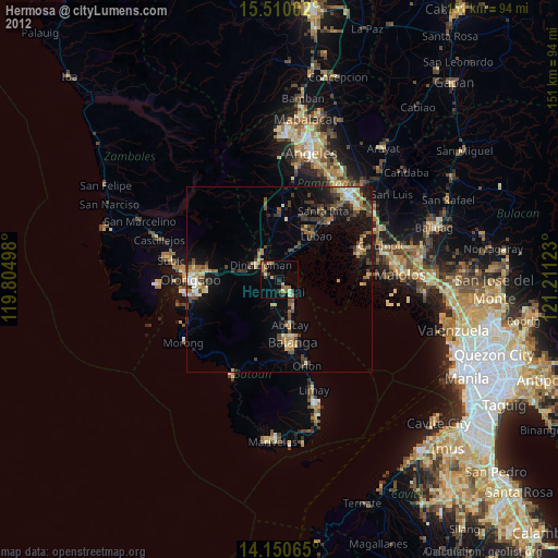
» Earth at Night: Flat Maps 2012, 2016