Santiago night lights from space
Night Light of Santiago (Central Luzon) from space (Philippines) Src. Average luminocity for 10x10km area is 6.969% and for 50x50km: 10.804%.
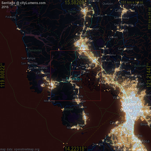
Analysis of Santiago night lights 2016
Square area 10x10 km:
 0%
0%90-99
0%80-89
0%70-79
1.03%60-69
0.83%50-59
1.86%40-49
1.65%30-39
3.31%20-29
1.45%10-19
4.13%0-9
85.74%Square area 50x50 km:
0.51%90-99
0.61%80-89
0.46%70-79
2.56%60-69
2.79%50-59
1.18%40-49
2.41%30-39
2.55%20-29
3.71%10-19
7.23%0-9
75.98%Clear (daylight) street map image can be seen on geolist.org.
Map coordinates:
15° 34' 55.5" North, 119° 48' 29.6" East
14° 54' 13.4" North, 120° 30' 40.8" East
14° 13' 23.4" North, 121° 12' 52.1" East
Some cities around Santiago sort by population:
• Dinalupihan
7 km =4.3 mi,  246°
246°
• Lubao
10.5 km =6.5 mi,  67°
67°
• Orani
11.8 km =7.3 mi,  166°
166°
• Hermosa
8 km =5 mi,  182°
182°
• Santa Cruz
6 km =3.7 mi,  80°
80°
• San Roque Dau First
10.8 km =6.7 mi,  40°
40°
• Pulungmasle
11.9 km =7.4 mi,  24°
24°
• Balsic
5.9 km =3.7 mi,  212°
212°
1687812 (p: 5,971)
Sources (retrieved 2019-11-25):
» Earth at Night: Flat Maps 2012, 2016