Dinalupihan night lights from space
Night Light of Dinalupihan (Central Luzon) from space (Philippines) Src. Average luminocity for 10x10km area is 15.2231% and for 50x50km: 8.9538%.
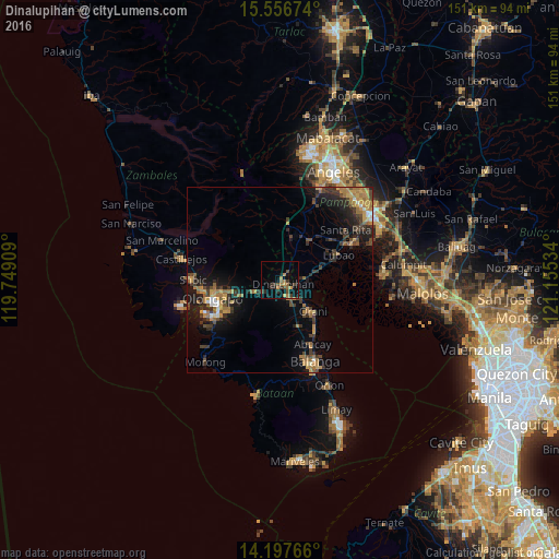
Analysis of Dinalupihan night lights 2016
Square area 10x10 km:
 0%
0%90-99
0%80-89
0.83%70-79
3.51%60-69
4.13%50-59
2.69%40-49
3.93%30-39
4.75%20-29
3.31%10-19
6.82%0-9
70.04%Square area 50x50 km:
0.37%90-99
0.45%80-89
0.34%70-79
2.06%60-69
2.36%50-59
0.88%40-49
1.93%30-39
2.26%20-29
2.89%10-19
6.32%0-9
80.13%Clear (daylight) street map image can be seen on geolist.org.
Map coordinates:
15° 33' 24.3" North, 119° 44' 56.7" East
14° 52' 41.8" North, 120° 27' 8" East
14° 11' 51.6" North, 121° 9' 19.2" East
Some cities around Dinalupihan sort by population:
• Lubao
17.4 km =10.8 mi,  66°
66°
• Orani
12.6 km =7.8 mi,  133°
133°
• Hermosa
8 km =5 mi, 130°
• Samal
15.7 km =9.8 mi,  141°
141°
• Santa Cruz
12.9 km =8 mi, 72°
• San Roque Dau First
17.3 km =10.7 mi,  50°
50°
• Santiago
7 km =4.3 mi, 66°
• Balsic
3.9 km =2.4 mi,  123°
123°
1714766 (p: 66,670)
Sources (retrieved 2019-11-25):
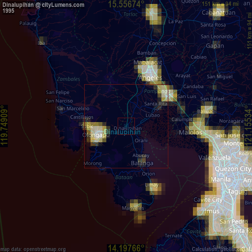
» NASA, Earths city lights 1995
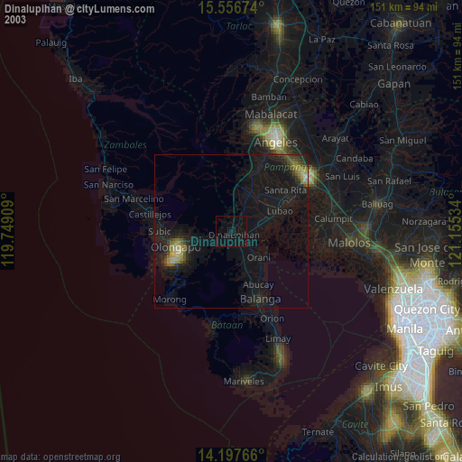
» NASA city lights 2003
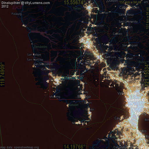
» Earth at Night: Flat Maps 2012, 2016