Hagonoy night lights from space
Night Light of Hagonoy (Central Luzon) from space (Philippines) Src. Average luminocity for 10x10km area is 10.3079% and for 50x50km: 17.3185%.
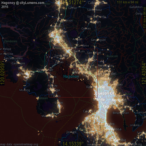
Analysis of Hagonoy night lights 2016
Square area 10x10 km:
 0%
0%90-99
0%80-89
0%70-79
0%60-69
1.45%50-59
1.03%40-49
2.48%30-39
7.23%20-29
5.17%10-19
15.29%0-9
67.36%Square area 50x50 km:
0.75%90-99
1.12%80-89
1.26%70-79
4.26%60-69
4.6%50-59
1.98%40-49
3.56%30-39
4.28%20-29
6%10-19
11.06%0-9
61.12%Clear (daylight) street map image can be seen on geolist.org.
Map coordinates:
15° 30' 45.9" North, 120° 1' 46.5" East
14° 50' 2.9" North, 120° 43' 57.8" East
14° 9' 12.2" North, 121° 26' 9" East
Some cities around Hagonoy sort by population:
• Malolos
8.4 km =5.2 mi,  82°
82°
• Calumpit
9.8 km =6.1 mi,  21°
21°
• Apalit
13.8 km =8.6 mi, 16°
• Pulilan
14.6 km =9.1 mi,  59°
59°
• Balagtas
14.5 km =9 mi,  97°
97°
• Paombong
6.1 km =3.8 mi,  93°
93°
• Masantol
7.3 km =4.5 mi,  339°
339°
• San Vicente
12.5 km =7.8 mi,  7°
7°
1711982 (p: 123,531)
Sources (retrieved 2019-11-25):
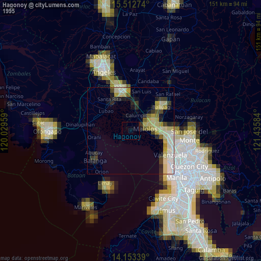
» NASA, Earths city lights 1995
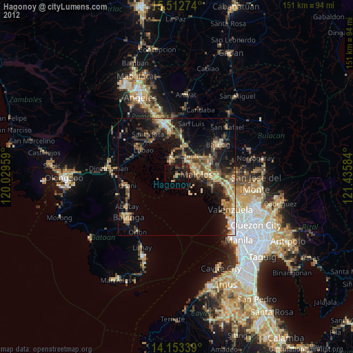
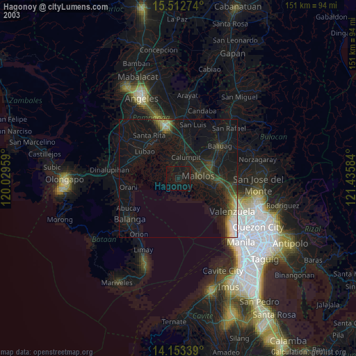
» NASA city lights 2003
» Earth at Night: Flat Maps 2012, 2016