Apalit night lights from space
Night Light of Apalit (Central Luzon) from space (Philippines) Src. Average luminocity for 10x10km area is 27.3864% and for 50x50km: 21.0675%.
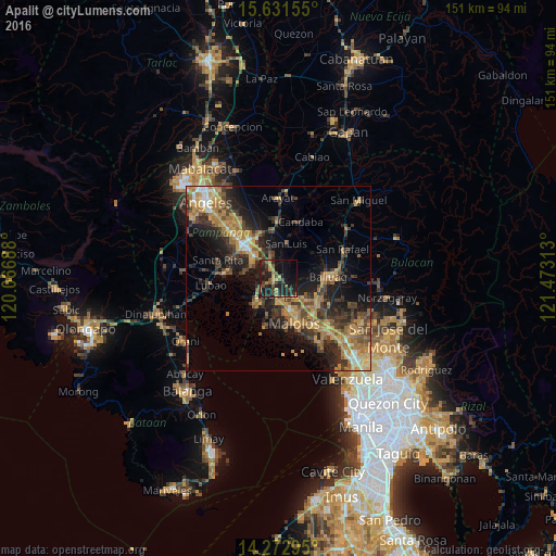
Analysis of Apalit night lights 2016
Square area 10x10 km:
 0%
0%90-99
0%80-89
0.83%70-79
6.82%60-69
4.75%50-59
6.4%40-49
7.23%30-39
7.44%20-29
13.02%10-19
36.78%0-9
16.74%Square area 50x50 km:
0.83%90-99
1.28%80-89
1.88%70-79
5.83%60-69
5.68%50-59
2.64%40-49
4.51%30-39
4.85%20-29
6.83%10-19
11.67%0-9
54%Clear (daylight) street map image can be seen on geolist.org.
Map coordinates:
15° 37' 53.6" North, 120° 4' 0.8" East
14° 57' 12" North, 120° 46' 12" East
14° 16' 22.6" North, 121° 28' 23.3" East
Some cities around Apalit sort by population:
• Calumpit
4.1 km =2.5 mi,  186°
186°
• Masantol
9.1 km =5.7 mi,  225°
225°
• San Simon
5.3 km =3.3 mi,  12°
12°
• Balucuc
4.8 km =3 mi,  90°
90°
• San Jose
9 km =5.6 mi, 9°
• San Vicente
2.4 km =1.5 mi,  250°
250°
• San Isidro
9.3 km =5.8 mi,  35°
35°
• Santo Domingo
5.1 km =3.2 mi,  325°
325°
1730413 (p: 77,418)
Sources (retrieved 2019-11-25):
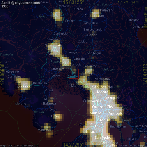
» NASA, Earths city lights 1995
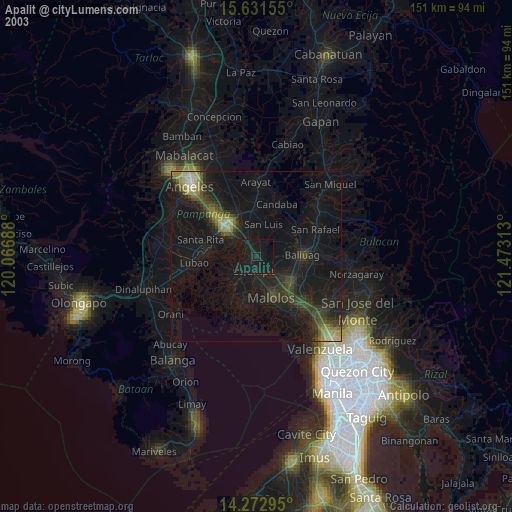
» NASA city lights 2003
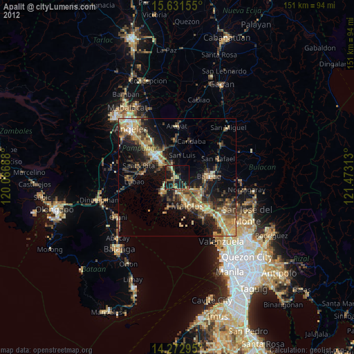
» Earth at Night: Flat Maps 2012, 2016