Masantol night lights from space
Night Light of Masantol (Central Luzon) from space (Philippines) Src. Average luminocity for 10x10km area is 17.0393% and for 50x50km: 17.1529%.
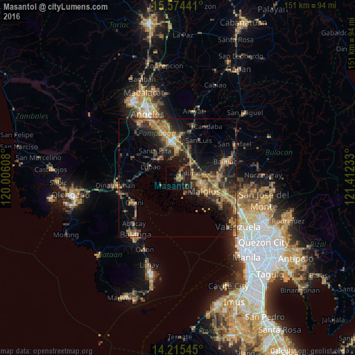
Analysis of Masantol night lights 2016
Square area 10x10 km:
 0%
0%90-99
0%80-89
1.65%70-79
0.83%60-69
3.31%50-59
4.55%40-49
4.34%30-39
3.31%20-29
7.44%10-19
23.55%0-9
51.03%Square area 50x50 km:
0.32%90-99
0.53%80-89
0.96%70-79
4.69%60-69
4.96%50-59
1.98%40-49
4.03%30-39
4.49%20-29
6.48%10-19
11.95%0-9
59.61%Clear (daylight) street map image can be seen on geolist.org.
Map coordinates:
15° 34' 27.9" North, 120° 0' 21.9" East
14° 53' 45.6" North, 120° 42' 33.1" East
14° 12' 55.6" North, 121° 24' 44.4" East
Some cities around Masantol sort by population:
• Hagonoy
7.3 km =4.5 mi,  159°
159°
• Calumpit
6.5 km =4 mi,  69°
69°
• Apalit
9.1 km =5.7 mi,  45°
45°
• Sexmoan
10.7 km =6.6 mi,  299°
299°
• Minalin
8.5 km =5.3 mi,  340°
340°
• Lourdes
8.3 km =5.2 mi, 340°
• San Vicente
7 km =4.3 mi,  37°
37°
• Santo Domingo
11.2 km =7 mi,  19°
19°
1700753 (p: 41,278)
Sources (retrieved 2019-11-25):
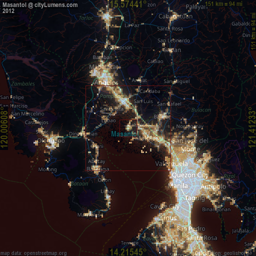
» Earth at Night: Flat Maps 2012, 2016