Bulacan night lights from space
Night Light of Bulacan (Central Luzon) from space (Philippines) Src. Average luminocity for 10x10km area is 34.6012% and for 50x50km: 31.1768%.
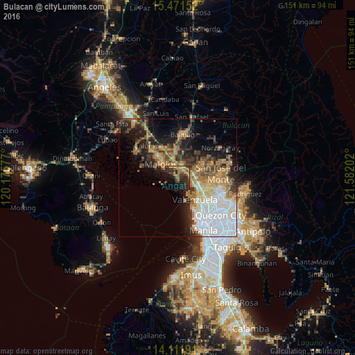

Analysis of Bulacan night lights 2016
Square area 10x10 km:
 0%
0%90-99
0%80-89
1.65%70-79
11.16%60-69
10.33%50-59
5.79%40-49
7.44%30-39
10.33%20-29
19.63%10-19
19.42%0-9
14.26%Square area 50x50 km:
8.57%90-99
4.16%80-89
2.59%70-79
5.33%60-69
5.94%50-59
2.91%40-49
4.03%30-39
4.27%20-29
6.08%10-19
10.95%0-9
45.16%Clear (daylight) street map image can be seen on geolist.org.
Map coordinates:
15° 28' 17.5" North, 120° 10' 32.8" East
14° 47' 34" North, 120° 52' 44" East
14° 6' 42.9" North, 121° 34' 55.3" East
Some cities around Bulacan sort by population:
• Malolos
9.3 km =5.8 mi,  307°
307°
• Bocaue
5.1 km =3.2 mi,  83°
83°
• Marilao
8.4 km =5.2 mi,  117°
117°
• Guiguinto
4.5 km =2.8 mi,  6°
6°
• Balagtas
3 km =1.9 mi,  333°
333°
• Paombong
10.5 km =6.5 mi,  293°
293°
• Lambakin
4.9 km =3 mi,  195°
195°
• Sulucan
5.1 km =3.2 mi,  87°
87°
1723066 (p: 71,274)
Sources (retrieved 2019-11-25):
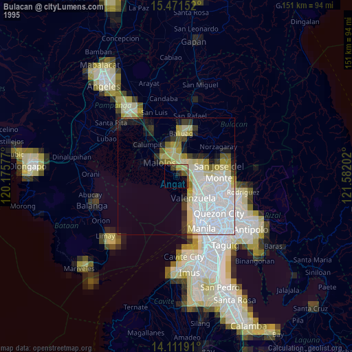
» NASA, Earths city lights 1995
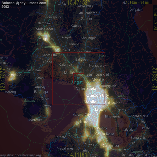
» NASA city lights 2003
» Earth at Night: Flat Maps 2012, 2016