Bocaue night lights from space
Night Light of Bocaue (Central Luzon) from space (Philippines) Src. Average luminocity for 10x10km area is 58.157% and for 50x50km: 34.0379%.
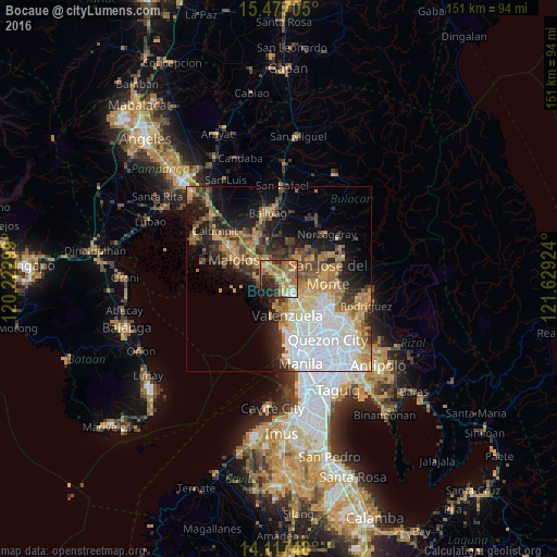
Analysis of Bocaue night lights 2016
Square area 10x10 km:
 3.72%
3.72%90-99
6.2%80-89
7.23%70-79
19.42%60-69
22.31%50-59
7.23%40-49
5.37%30-39
8.06%20-29
14.67%10-19
5.79%0-9
0%Square area 50x50 km:
8.81%90-99
4.66%80-89
3.03%70-79
6.66%60-69
6.78%50-59
3.27%40-49
4.04%30-39
4.4%20-29
6.02%10-19
11.04%0-9
41.28%Clear (daylight) street map image can be seen on geolist.org.
Map coordinates:
15° 28' 37.4" North, 120° 13' 22.8" East
14° 47' 54" North, 120° 55' 34" East
14° 7' 2.9" North, 121° 37' 45.3" East
Some cities around Bocaue sort by population:
• Meycauayan
7.8 km =4.8 mi,  151°
151°
• Guyong
7 km =4.3 mi,  53°
53°
• Marilao
5.1 km =3.2 mi, 152°
• Guiguinto
6 km =3.7 mi,  310°
310°
• Bulacan
5.1 km =3.2 mi,  263°
263°
• Balagtas
6.7 km =4.2 mi,  287°
287°
• Loma de Gato
7.9 km =4.9 mi,  97°
97°
• Sulucan
0.4 km =0.2 mi,  182°
182°
1724489 (p: 98,649)
Sources (retrieved 2019-11-25):
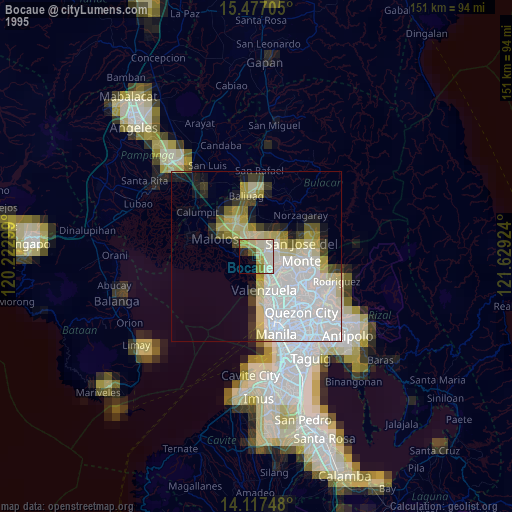
» NASA, Earths city lights 1995
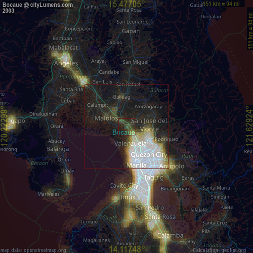
» NASA city lights 2003
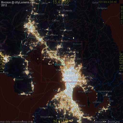
» Earth at Night: Flat Maps 2012, 2016