General Tinio night lights from space
Night Light of General Tinio (Central Luzon) from space (Philippines) Src. Average luminocity for 10x10km area is 0.8658% and for 50x50km: 2.926%.
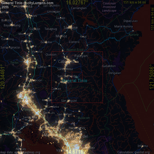
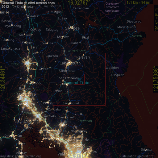
Analysis of General Tinio night lights 2016
Square area 10x10 km:
 0%
0%90-99
0%80-89
0%70-79
0%60-69
0%50-59
0%40-49
0%30-39
0.87%20-29
0.87%10-19
0.87%0-9
97.4%Square area 50x50 km:
0%90-99
0.03%80-89
0.22%70-79
0.79%60-69
0.58%50-59
0.27%40-49
0.83%30-39
0.67%20-29
0.75%10-19
2.1%0-9
93.76%Clear (daylight) street map image can be seen on geolist.org.
Map coordinates:
16° 1' 39.6" North, 120° 20' 40.6" East
15° 21' 2.7" North, 121° 2' 51.8" East
14° 40' 17.8" North, 121° 45' 3.1" East
Some cities around General Tinio sort by population:
• Cabanatuan City
17.4 km =10.8 mi,  329°
329°
• Gapan
11.9 km =7.4 mi,  245°
245°
• Jaen
14 km =8.7 mi,  259°
259°
• San Leonardo
9.1 km =5.7 mi,  278°
278°
• Peñaranda
4.7 km =2.9 mi,  270°
270°
• Santa Rosa
14.3 km =8.9 mi,  304°
304°
• Pulo
17.3 km =10.7 mi,  227°
227°
• Nieves
10.9 km =6.8 mi, 256°
1713018 (p: 32,875)
Sources (retrieved 2019-11-25):
» Earth at Night: Flat Maps 2012, 2016