Cabanatuan City night lights from space
Night Light of Cabanatuan City (Central Luzon) from space (Philippines) Src. Average luminocity for 10x10km area is 29.6385% and for 50x50km: 3.0664%.
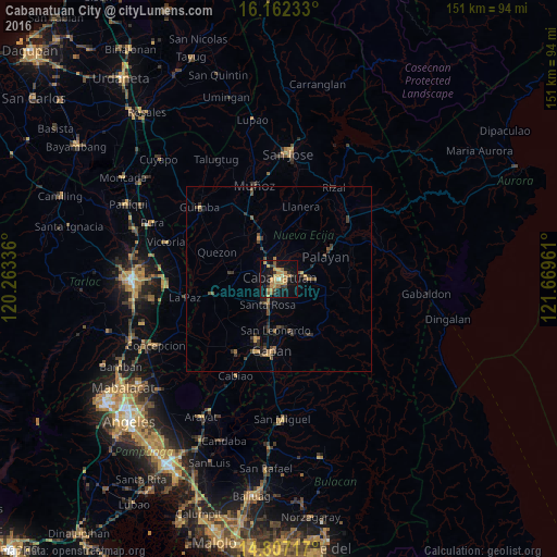
Analysis of Cabanatuan City night lights 2016
Square area 10x10 km:
 0%
0%90-99
0.87%80-89
3.68%70-79
12.77%60-69
6.49%50-59
3.03%40-49
2.81%30-39
4.55%20-29
4.76%10-19
37.23%0-9
23.81%Square area 50x50 km:
0%90-99
0.03%80-89
0.21%70-79
0.81%60-69
0.51%50-59
0.27%40-49
1.03%30-39
0.85%20-29
0.68%10-19
2.2%0-9
93.4%Clear (daylight) street map image can be seen on geolist.org.
Map coordinates:
16° 9' 44.4" North, 120° 15' 48.1" East
15° 29' 9.1" North, 120° 57' 59.3" East
14° 48' 25.8" North, 121° 40' 10.6" East
Some cities around Cabanatuan City sort by population:
• Talavera
12.5 km =7.8 mi,  336°
336°
• San Leonardo
13.7 km =8.5 mi,  181°
181°
• Aliaga
13.3 km =8.3 mi,  276°
276°
• Santa Rosa
7.6 km =4.7 mi,  204°
204°
• Rajal Norte
12 km =7.5 mi,  247°
247°
• Mabini
12.8 km =8 mi,  8°
8°
• Bibiclat
11.9 km =7.4 mi,  289°
289°
• Santo Rosario
10 km =6.2 mi,  235°
235°
1721906 (p: 220,250)
Sources (retrieved 2019-11-25):
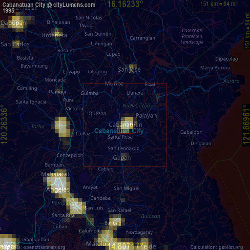
» NASA, Earths city lights 1995
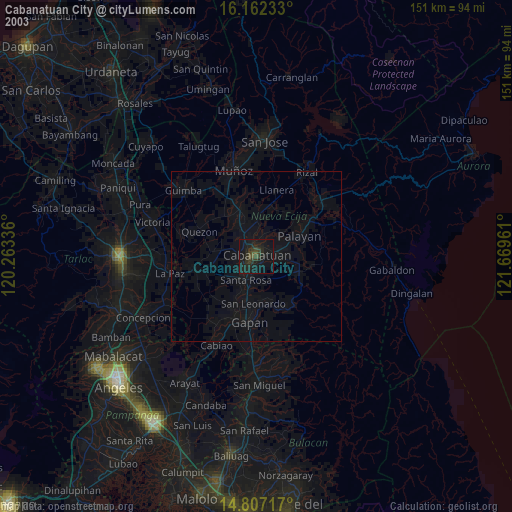
» NASA city lights 2003
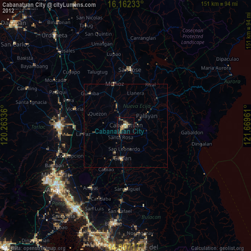
» Earth at Night: Flat Maps 2012, 2016