Santo Domingo night lights from space
Night Light of Santo Domingo (Central Luzon) from space (Philippines) Src. Average luminocity for 10x10km area is 32.8698% and for 50x50km: 21.1191%.
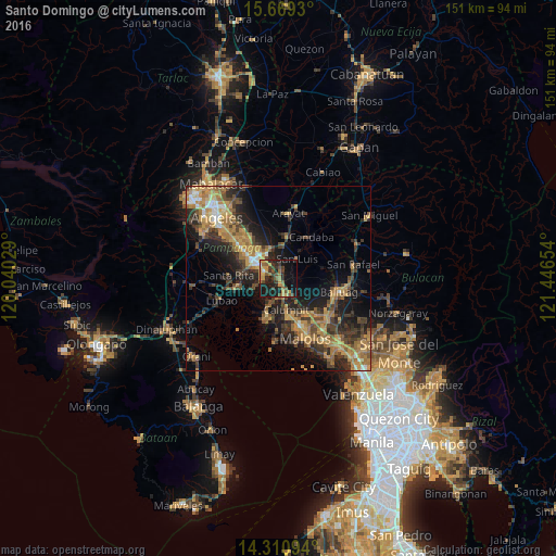
Analysis of Santo Domingo night lights 2016
Square area 10x10 km:
 1.03%
1.03%90-99
0.21%80-89
1.65%70-79
11.36%60-69
5.79%50-59
7.23%40-49
6.61%30-39
7.64%20-29
12.19%10-19
33.47%0-9
12.81%Square area 50x50 km:
0.92%90-99
1.26%80-89
1.64%70-79
5.89%60-69
5.89%50-59
2.48%40-49
4.58%30-39
4.81%20-29
7.07%10-19
11.76%0-9
53.7%Clear (daylight) street map image can be seen on geolist.org.
Map coordinates:
15° 40' 9.5" North, 120° 2' 25" East
14° 59' 28.3" North, 120° 44' 36.3" East
14° 18' 39.4" North, 121° 26' 47.5" East
Some cities around Santo Domingo sort by population:
• Apalit
5.1 km =3.2 mi,  145°
145°
• Del Pilar
6.9 km =4.3 mi,  316°
316°
• San Luis
7.3 km =4.5 mi,  41°
41°
• San Simon
4.1 km =2.5 mi,  76°
76°
• Minalin
7 km =4.3 mi,  248°
248°
• Lourdes
7 km =4.3 mi, 247°
• San Jose
6.3 km =3.9 mi, 42°
• San Vicente
5.1 km =3.2 mi,  173°
173°
1687725 (p: 5,045)
Sources (retrieved 2019-11-25):
» Earth at Night: Flat Maps 2012, 2016