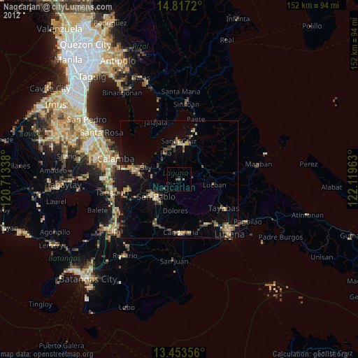
Nagcarlan night lights from space
Night Light of Nagcarlan (Calabarzon) from space (Philippines) Src. Average luminocity for 10x10km area is 4.7165% and for 50x50km: 8.8345%.
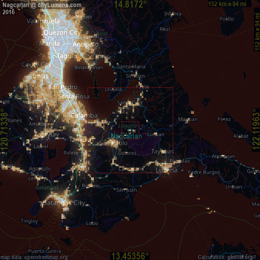
Analysis of Nagcarlan night lights 2016
Square area 10x10 km:
 0%
0%90-99
0%80-89
0.65%70-79
1.08%60-69
0%50-59
0.87%40-49
2.6%30-39
1.08%20-29
1.52%10-19
0%0-9
92.21%Square area 50x50 km:
0.08%90-99
0.09%80-89
0.59%70-79
2.29%60-69
1.84%50-59
1.2%40-49
1.62%30-39
2.23%20-29
2.24%10-19
8.53%0-9
79.3%Clear (daylight) street map image can be seen on geolist.org.
Map coordinates:
14° 49' 1.9" North, 120° 42' 48.2" East
14° 8' 11" North, 121° 24' 59.4" East
13° 27' 12.8" North, 122° 7' 10.7" East
Some cities around Nagcarlan sort by population:
• San Pablo
12.4 km =7.7 mi,  232°
232°
• Calauan
11 km =6.8 mi,  277°
277°
• Pila
12.1 km =7.5 mi,  332°
332°
• Victoria
13.8 km =8.6 mi,  317°
317°
• Lilio
2.2 km =1.4 mi,  104°
104°
• Majayjay
6.2 km =3.9 mi,  79°
79°
• Dolores
12.7 km =7.9 mi,  183°
183°
• Dayap
10.2 km =6.3 mi,  298°
298°
1698740 (p: 24,560)
Sources (retrieved 2019-11-25):
» Earth at Night: Flat Maps 2012, 2016