Silang night lights from space
Night Light of Silang (Calabarzon) from space (Philippines) Src. Average luminocity for 10x10km area is 32.7013% and for 50x50km: 31.6359%.
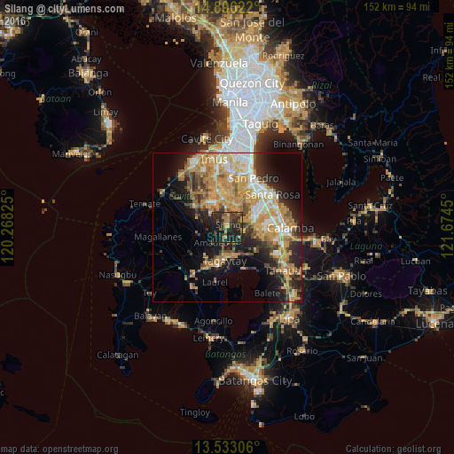
Analysis of Silang night lights 2016
Square area 10x10 km:
 0%
0%90-99
0%80-89
1.52%70-79
7.79%60-69
6.71%50-59
4.11%40-49
11.26%30-39
9.96%20-29
23.59%10-19
33.77%0-9
1.3%Square area 50x50 km:
2.99%90-99
4.69%80-89
4%70-79
10.21%60-69
6.48%50-59
2.86%40-49
4.35%30-39
3.82%20-29
6.91%10-19
12.05%0-9
41.66%Clear (daylight) street map image can be seen on geolist.org.
Map coordinates:
14° 53' 46.4" North, 120° 16' 5.7" East
14° 12' 56.4" North, 120° 58' 16.9" East
13° 31' 59" North, 121° 40' 28.2" East
Some cities around Silang sort by population:
• Patuto
11 km =6.8 mi,  182°
182°
• Indang
10.4 km =6.5 mi,  257°
257°
• Amadeo
7.2 km =4.5 mi,  225°
225°
• Bulihan
7.4 km =4.6 mi,  20°
20°
• Manggahan
11.3 km =7 mi,  318°
318°
• Balite Segundo
3.6 km =2.2 mi,  174°
174°
• Malabag
6.8 km =4.2 mi,  185°
185°
• Maguyam
6.4 km =4 mi,  34°
34°
1686547 (p: 119,475)
Sources (retrieved 2019-11-25):
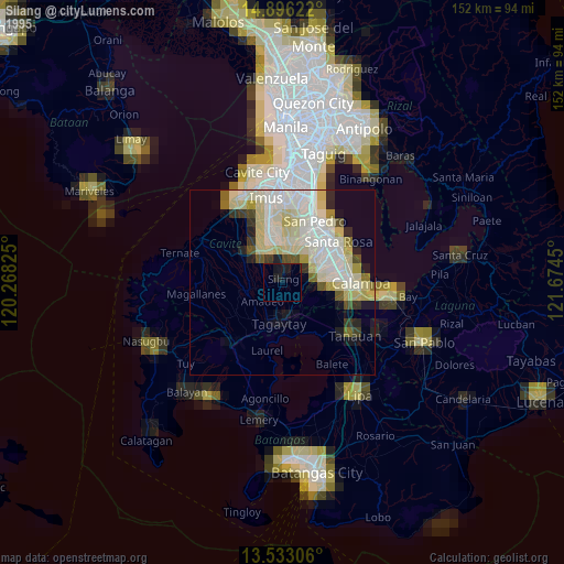
» NASA, Earths city lights 1995
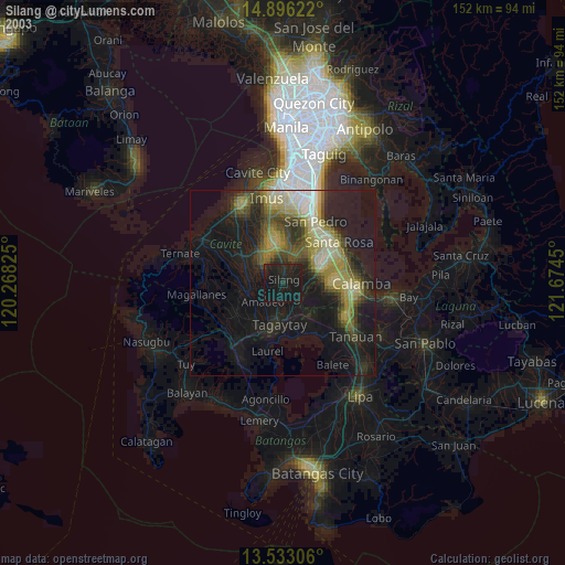
» NASA city lights 2003
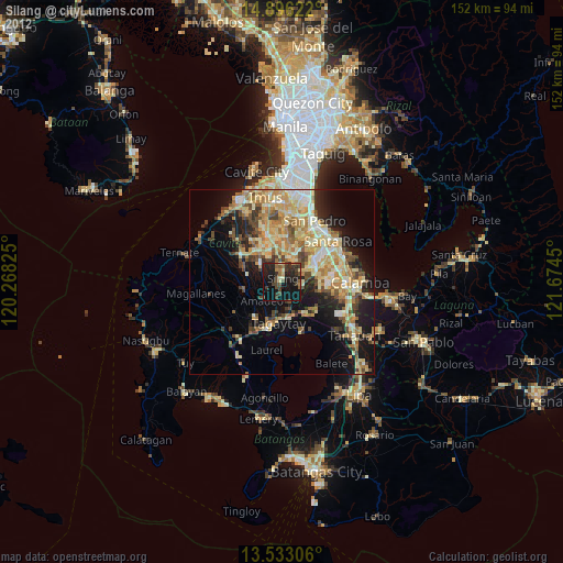
» Earth at Night: Flat Maps 2012, 2016