Balele night lights from space
Night Light of Balele (Calabarzon) from space (Philippines) Src. Average luminocity for 10x10km area is 15.4892% and for 50x50km: 22.7524%.
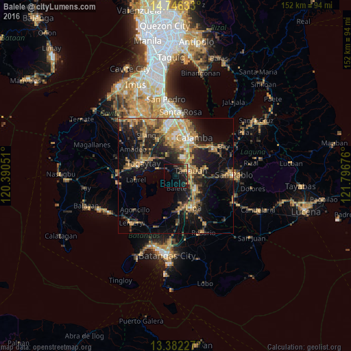
Analysis of Balele night lights 2016
Square area 10x10 km:
 0%
0%90-99
0.22%80-89
0.43%70-79
3.46%60-69
0.65%50-59
1.08%40-49
6.71%30-39
3.68%20-29
8.66%10-19
24.89%0-9
50.22%Square area 50x50 km:
1.26%90-99
1.88%80-89
1.97%70-79
7.12%60-69
4.63%50-59
2.47%40-49
4.31%30-39
3.95%20-29
6.02%10-19
15.59%0-9
50.81%Clear (daylight) street map image can be seen on geolist.org.
Map coordinates:
14° 44' 46.8" North, 120° 23' 25.8" East
14° 3' 55.2" North, 121° 5' 37.1" East
13° 22' 56.2" North, 121° 47' 48.3" East
Some cities around Balele sort by population:
• Tanauan
6.5 km =4 mi,  68°
68°
• Santo Tomas
7 km =4.3 mi,  47°
47°
• Malvar
7.4 km =4.6 mi,  108°
108°
• Bilog-Bilog
5.4 km =3.4 mi,  354°
354°
• Ambulong
4.3 km =2.7 mi,  305°
305°
• Balete
5.1 km =3.2 mi,  178°
178°
• Pantay Na Matanda
6.5 km =4 mi,  27°
27°
• Janopol
2.3 km =1.4 mi,  3°
3°
1728275 (p: 6,496)
Sources (retrieved 2019-11-25):
» Earth at Night: Flat Maps 2012, 2016