Tanauan night lights from space
Night Light of Tanauan (Calabarzon) from space (Philippines) Src. Average luminocity for 10x10km area is 45.1407% and for 50x50km: 23.8552%.
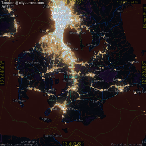
Analysis of Tanauan night lights 2016
Square area 10x10 km:
 0.65%
0.65%90-99
1.08%80-89
5.19%70-79
18.4%60-69
10.82%50-59
3.68%40-49
9.09%30-39
11.9%20-29
25.32%10-19
13.42%0-9
0.43%Square area 50x50 km:
1.44%90-99
2.12%80-89
2.26%70-79
7.63%60-69
5.08%50-59
2.55%40-49
4.16%30-39
4.01%20-29
5.9%10-19
14.8%0-9
50.07%Clear (daylight) street map image can be seen on geolist.org.
Map coordinates:
14° 46' 2" North, 120° 26' 47.9" East
14° 5' 10.6" North, 121° 8' 59.1" East
13° 24' 11.8" North, 121° 51' 10.4" East
Some cities around Tanauan sort by population:
• Santo Tomas
2.6 km =1.6 mi,  339°
339°
• Malvar
4.7 km =2.9 mi,  168°
168°
• Bilog-Bilog
7.3 km =4.5 mi,  294°
294°
• Balele
6.5 km =4 mi,  248°
248°
• Pantay Na Matanda
4.6 km =2.9 mi,  318°
318°
• Bitin
8.5 km =5.3 mi,  66°
66°
• San Andres
8.3 km =5.2 mi,  119°
119°
• Janopol
5.9 km =3.7 mi,  269°
269°
1683340 (p: 68,456)
Sources (retrieved 2019-11-25):
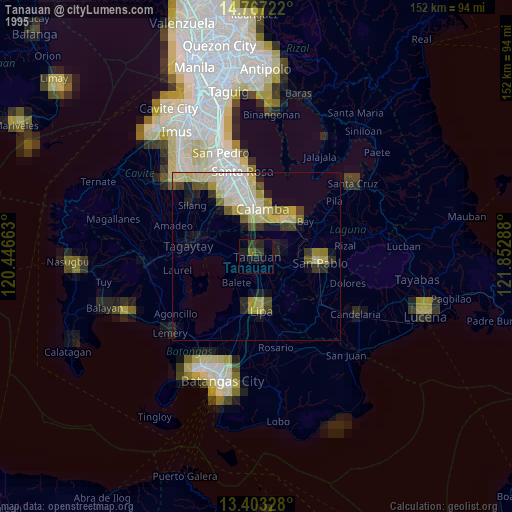
» NASA, Earths city lights 1995
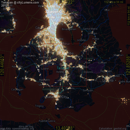
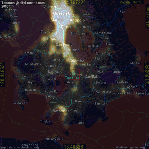
» NASA city lights 2003
» Earth at Night: Flat Maps 2012, 2016