Buanoy night lights from space
Night Light of Buanoy (Central Visayas) from space (Philippines) Src. Average luminocity for 10x10km area is 12.9607% and for 50x50km: 7.9189%.
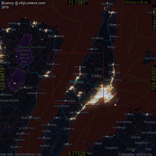
Analysis of Buanoy night lights 2016
Square area 10x10 km:
 1.03%
1.03%90-99
0.62%80-89
2.07%70-79
1.65%60-69
1.24%50-59
1.24%40-49
4.55%30-39
2.48%20-29
2.69%10-19
3.1%0-9
79.34%Square area 50x50 km:
1.6%90-99
1.41%80-89
0.92%70-79
0.86%60-69
0.71%50-59
0.66%40-49
1.37%30-39
1.16%20-29
2.28%10-19
2.9%0-9
86.14%Clear (daylight) street map image can be seen on geolist.org.
Map coordinates:
11° 9' 29.2" North, 122° 59' 48.4" East
10° 28' 2.9" North, 123° 41' 59.6" East
9° 46' 31" North, 124° 24' 10.9" East
Some cities around Buanoy sort by population:
• Toledo
12.1 km =7.5 mi,  213°
213°
• Pinamungahan
25.3 km =15.7 mi, 210°
• Apas
26.3 km =16.3 mi,  122°
122°
• Balamban
4.4 km =2.7 mi,  22°
22°
• Jaclupan
22.4 km =13.9 mi,  145°
145°
• Asturias
11.2 km =7 mi,  9°
9°
• Lunas
20 km =12.4 mi, 16°
• Tajao
21.2 km =13.2 mi,  216°
216°
1723701 (p: 10,955)
Sources (retrieved 2019-11-25):
» Earth at Night: Flat Maps 2012, 2016