Arayat night lights from space
Night Light of Arayat (Central Luzon) from space (Philippines) Src. Average luminocity for 10x10km area is 6.2975% and for 50x50km: 15.2217%.
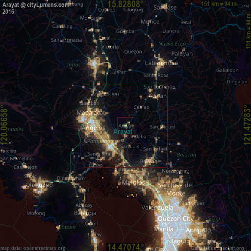
Analysis of Arayat night lights 2016
Square area 10x10 km:
 0%
0%90-99
0%80-89
0.62%70-79
1.86%60-69
0%50-59
0.83%40-49
0.41%30-39
3.93%20-29
2.27%10-19
0.62%0-9
89.46%Square area 50x50 km:
0.73%90-99
0.96%80-89
1.1%70-79
3.98%60-69
3.74%50-59
1.6%40-49
3.46%30-39
3.18%20-29
4.91%10-19
10.24%0-9
66.1%Clear (daylight) street map image can be seen on geolist.org.
Map coordinates:
15° 49' 41.1" North, 120° 3' 59.7" East
15° 9' 1.8" North, 120° 46' 10.9" East
14° 28' 14.7" North, 121° 28' 22.2" East
Some cities around Arayat sort by population:
• Candaba
8.6 km =5.3 mi,  134°
134°
• Santa Ana
6.1 km =3.8 mi,  182°
182°
• Mexico
11 km =6.8 mi,  209°
209°
• San Luis
12.4 km =7.7 mi,  170°
170°
• Pandacaqui
12.6 km =7.8 mi,  280°
280°
• San Jose
13.1 km =8.1 mi, 173°
• San Vicente
8.8 km =5.5 mi,  37°
37°
• Cauayan
10.5 km =6.5 mi,  270°
270°
1730225 (p: 87,987)
Sources (retrieved 2019-11-25):
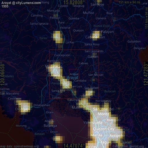
» NASA, Earths city lights 1995
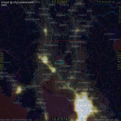
» NASA city lights 2003
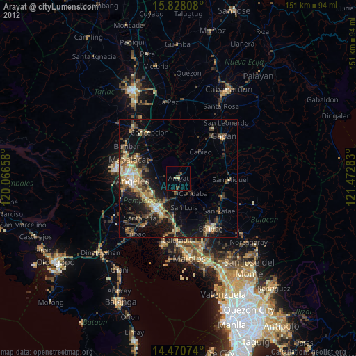
» Earth at Night: Flat Maps 2012, 2016