Trujillo night lights from space
Night Light of Trujillo (La Libertad) from space (Peru) Src. Average luminocity for 10x10km area is 84.9318% and for 50x50km: 10.1654%.
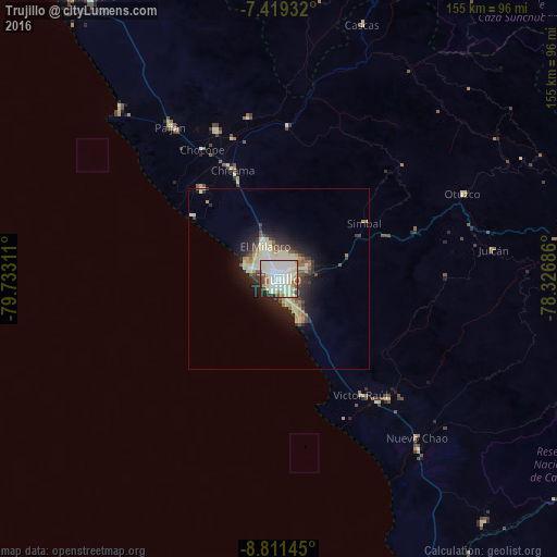

Analysis of Trujillo night lights 2016
Square area 10x10 km:
 34.09%
90-99
27.48%80-89
14.88%70-79
1.24%60-69
6.4%50-59
4.13%40-49
4.55%30-39
2.69%20-29
3.72%10-19
0.83%0-9
0%Square area 50x50 km:
1.84%90-99
1.74%80-89
2.66%70-79
0.58%60-69
0.88%50-59
0.98%40-49
1.12%30-39
1.31%20-29
2.53%10-19
5.29%0-9
81.06%Clear (daylight) street map image can be seen on geolist.org.
Map coordinates:
7° 25' 9.6" South, 79° 43' 59.2" West
8° 6' 57.6" South, 79° 1' 47.9" West
8° 48' 41.2" South, 78° 19' 36.7" West
Some cities around Trujillo sort by population:
• Chocope
41.8 km =26 mi,  329°
329°
• Laredo
8.2 km =5.1 mi,  69°
69°
• Moche
6.5 km =4 mi,  159°
159°
• Santiago de Cao
28.9 km =18 mi,  307°
307°
• Virú
45.2 km =28.1 mi,  137°
137°
• Chicama
32.8 km =20.4 mi,  336°
336°
• Ascope
45.5 km =28.3 mi,  349°
349°
• Salaverry
13.1 km =8.1 mi,  153°
153°
3691175 (p: 747,450)
Sources (retrieved 2019-11-25):
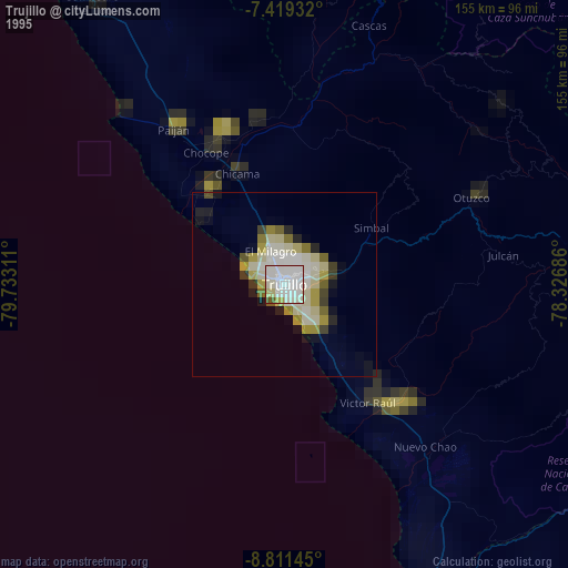
» NASA, Earths city lights 1995
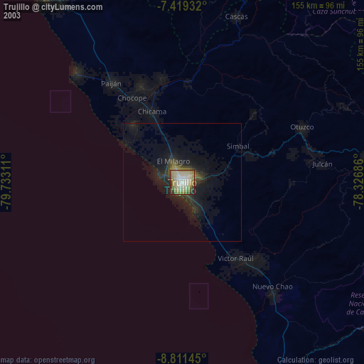
» NASA city lights 2003
» Earth at Night: Flat Maps 2012, 2016