Satipo night lights from space
Night Light of Satipo (Junin) from space (Peru) Src. Average luminocity for 10x10km area is 9.8074% and for 50x50km: 0.6799%.
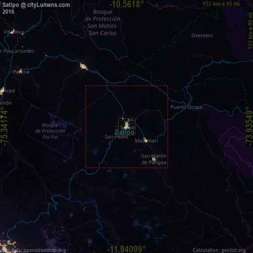
Analysis of Satipo night lights 2016
Square area 10x10 km:
 0%
0%90-99
0%80-89
0.43%70-79
4.33%60-69
3.46%50-59
1.73%40-49
0.87%30-39
1.73%20-29
1.3%10-19
1.08%0-9
85.06%Square area 50x50 km:
0%90-99
0%80-89
0.03%70-79
0.31%60-69
0.24%50-59
0.07%40-49
0.1%30-39
0.1%20-29
0.14%10-19
0.09%0-9
98.92%Clear (daylight) street map image can be seen on geolist.org.
Map coordinates:
10° 33' 42.5" South, 75° 20' 30.3" West
11° 15' 8" South, 74° 38' 19" West
11° 56' 27.6" South, 73° 56' 7.8" West
Some cities around Satipo sort by population:
• Huancayo
109.4 km =68 mi,  214°
214°
• San Ramón
79.7 km =49.5 mi,  280°
280°
• Concepción
104.3 km =64.8 mi,  224°
224°
• San Jerónimo
105.2 km =65.4 mi, 221°
• Villa Rica
89.4 km =55.6 mi,  309°
309°
• Perené
72.4 km =45 mi,  298°
298°
• Mazamari
14.3 km =8.9 mi,  124°
124°
• San Agustin
104.5 km =64.9 mi, 220°
3928924 (p: 15,532)
Sources (retrieved 2019-11-25):
» Earth at Night: Flat Maps 2012, 2016