Concepción night lights from space
Night Light of Concepción (Junin) from space (Peru) Src. Average luminocity for 10x10km area is 27.9463% and for 50x50km: 10.4247%.
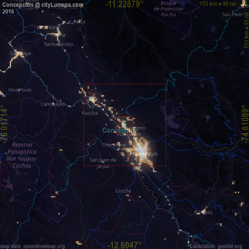
Analysis of Concepción night lights 2016
Square area 10x10 km:
 0.41%
0.41%90-99
0.41%80-89
0%70-79
8.68%60-69
11.16%50-59
4.55%40-49
5.58%30-39
2.27%20-29
4.75%10-19
41.32%0-9
20.87%Square area 50x50 km:
0.76%90-99
0.99%80-89
0.47%70-79
2.58%60-69
2.73%50-59
1.45%40-49
1.68%30-39
1.72%20-29
2.79%10-19
6.76%0-9
78.08%Clear (daylight) street map image can be seen on geolist.org.
Map coordinates:
11° 13' 43.6" South, 76° 1' 1.7" West
11° 55' 3.4" South, 75° 18' 50.4" West
12° 36' 16.9" South, 74° 36' 39.2" West
Some cities around Concepción sort by population:
• Huancayo
20.2 km =12.6 mi,  144°
144°
• Jauja
25.4 km =15.8 mi,  308°
308°
• Chupaca
16.9 km =10.5 mi,  168°
168°
• San Jerónimo
5.4 km =3.4 mi, 142°
• Pilcomay
16 km =9.9 mi,  153°
153°
• Sicaya
13.3 km =8.3 mi, 165°
• San Agustin
8.8 km =5.5 mi,  133°
133°
• Huayucachi
25.5 km =15.8 mi,  159°
159°
3942548 (p: 11,330)
Sources (retrieved 2019-11-25):
» Earth at Night: Flat Maps 2012, 2016