Villa Rica night lights from space
Night Light of Villa Rica (Pasco) from space (Peru) Src. Average luminocity for 10x10km area is 3.126% and for 50x50km: 0.4573%.
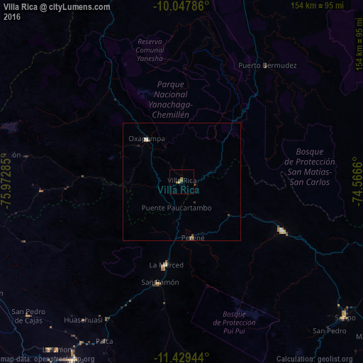
Analysis of Villa Rica night lights 2016
Square area 10x10 km:
 0%
0%90-99
0%80-89
0.83%70-79
0%60-69
1.65%50-59
0.83%40-49
0%30-39
0.83%20-29
0.83%10-19
0%0-9
95.04%Square area 50x50 km:
0.06%90-99
0.04%80-89
0.03%70-79
0.06%60-69
0.08%50-59
0.13%40-49
0.14%30-39
0.07%20-29
0.07%10-19
0.03%0-9
99.29%Clear (daylight) street map image can be seen on geolist.org.
Map coordinates:
10° 2' 52.3" South, 75° 58' 22.3" West
10° 44' 22" South, 75° 16' 11" West
11° 25' 46" South, 74° 33' 59.8" West
Some cities around Villa Rica sort by population:
• Tarma
88.4 km =54.9 mi,  211°
211°
• Satipo
89.4 km =55.6 mi,  129°
129°
• San Ramón
43.8 km =27.2 mi,  192°
192°
• Oxapampa
23.1 km =14.4 mi,  321°
321°
• Carhuamayo
85.7 km =53.3 mi,  256°
256°
• Perené
23.4 km =14.5 mi,  167°
167°
• San Pedro de Cajas
86 km =53.4 mi,  228°
228°
• Huasahuasi
71.5 km =44.4 mi,  215°
215°
3926120 (p: 7,448)
Sources (retrieved 2019-11-25):
» Earth at Night: Flat Maps 2012, 2016