Santiago de Cao night lights from space
Night Light of Santiago de Cao (La Libertad) from space (Peru) Src. Average luminocity for 10x10km area is 3.531% and for 50x50km: 7.4389%.
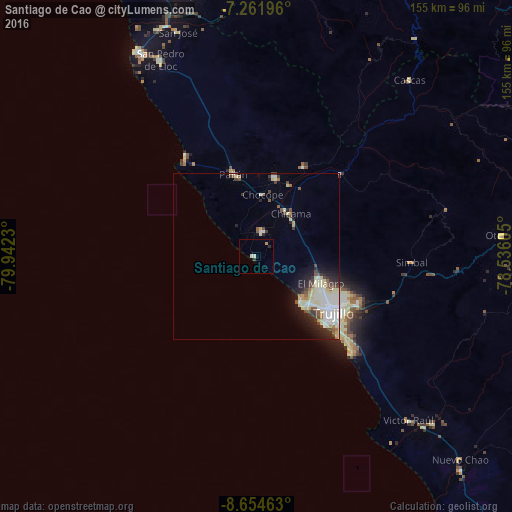
Analysis of Santiago de Cao night lights 2016
Square area 10x10 km:
 0.41%
0.41%90-99
1.24%80-89
0%70-79
0.83%60-69
0%50-59
0%40-49
0%30-39
0.83%20-29
0.83%10-19
0%0-9
95.87%Square area 50x50 km:
1.57%90-99
1.52%80-89
1.8%70-79
0.31%60-69
0.41%50-59
0.75%40-49
0.84%30-39
0.93%20-29
1.49%10-19
2.65%0-9
87.72%Clear (daylight) street map image can be seen on geolist.org.
Map coordinates:
7° 15' 43.1" South, 79° 56' 32.3" West
7° 57' 32" South, 79° 14' 21" West
8° 39' 16.7" South, 78° 32' 9.8" West
Some cities around Santiago de Cao sort by population:
• Trujillo
28.9 km =18 mi,  127°
127°
• Chocope
18.7 km =11.6 mi,  5°
5°
• Laredo
34 km =21.1 mi,  115°
115°
• Moche
34.6 km =21.5 mi, 132°
• Paiján
26 km =16.2 mi,  344°
344°
• Chicama
16.3 km =10.1 mi,  38°
38°
• Ascope
30.8 km =19.1 mi,  28°
28°
• Salaverry
41 km =25.5 mi,  135°
135°
3692073 (p: 21,982)
Sources (retrieved 2019-11-25):
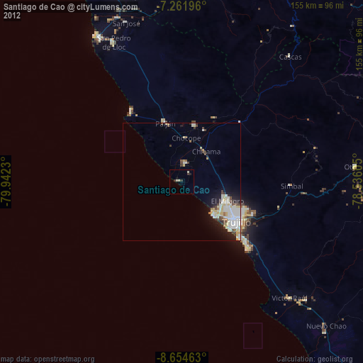
» Earth at Night: Flat Maps 2012, 2016