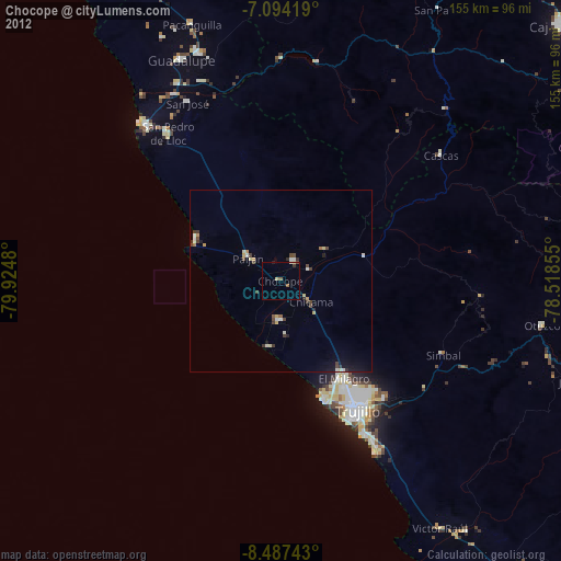
Chocope night lights from space
Night Light of Chocope (La Libertad) from space (Peru) Src. Average luminocity for 10x10km area is 6.3616% and for 50x50km: 2.4455%.
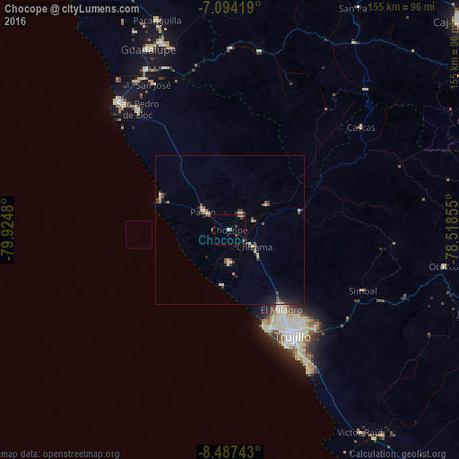
Analysis of Chocope night lights 2016
Square area 10x10 km:
 0.21%
0.21%90-99
1.03%80-89
1.24%70-79
0%60-69
0.62%50-59
1.86%40-49
1.45%30-39
0.21%20-29
0.83%10-19
0.83%0-9
91.74%Square area 50x50 km:
0.13%90-99
0.3%80-89
0.4%70-79
0.15%60-69
0.25%50-59
0.45%40-49
0.51%30-39
0.47%20-29
0.48%10-19
1.02%0-9
95.84%Clear (daylight) street map image can be seen on geolist.org.
Map coordinates:
7° 5' 39.1" South, 79° 55' 29.3" West
7° 47' 29" South, 79° 13' 18" West
8° 29' 14.7" South, 78° 31' 6.8" West
Some cities around Chocope sort by population:
• Trujillo
41.8 km =26 mi,  149°
149°
• Laredo
43.9 km =27.3 mi,  139°
139°
• Moche
48.3 km =30 mi, 151°
• Santiago de Cao
18.7 km =11.6 mi,  185°
185°
• Paiján
10.9 km =6.8 mi,  306°
306°
• San Pedro de Lloc
50.9 km =31.6 mi,  322°
322°
• Chicama
10.1 km =6.3 mi,  125°
125°
• Ascope
15.2 km =9.4 mi,  55°
55°
3698194 (p: 32,370)
Sources (retrieved 2019-11-25):
» Earth at Night: Flat Maps 2012, 2016