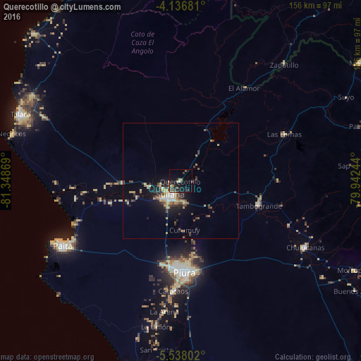
Querecotillo night lights from space
Night Light of Querecotillo (Piura) from space (Peru) Src. Average luminocity for 10x10km area is 16.6405% and for 50x50km: 5.5381%.

Analysis of Querecotillo night lights 2016
Square area 10x10 km:
 0.21%
0.21%90-99
1.65%80-89
3.31%70-79
1.03%60-69
1.24%50-59
1.24%40-49
6.2%30-39
2.69%20-29
4.34%10-19
20.87%0-9
57.23%Square area 50x50 km:
0.35%90-99
0.45%80-89
1.34%70-79
0.56%60-69
0.47%50-59
0.72%40-49
1.31%30-39
1.07%20-29
1.19%10-19
4.02%0-9
88.52%Clear (daylight) street map image can be seen on geolist.org.
Map coordinates:
4° 8' 12.5" South, 81° 20' 55.3" West
4° 50' 16" South, 80° 38' 44" West
5° 32' 16.9" South, 79° 56' 32.8" West
Some cities around Querecotillo sort by population:
• Piura
39.7 km =24.7 mi,  177°
177°
• Sullana
8.6 km =5.3 mi,  210°
210°
• Catacaos
47.9 km =29.8 mi,  185°
185°
• Tambo Grande
34.8 km =21.6 mi,  106°
106°
• Marcavelica
8 km =5 mi,  236°
236°
• Las Lomas
48.7 km =30.3 mi,  65°
65°
• La Huaca
35.8 km =22.2 mi,  256°
256°
• Salitral
4.5 km =2.8 mi, 241°
3693057 (p: 25,396)
Sources (retrieved 2019-11-25):
» Earth at Night: Flat Maps 2012, 2016