La Huaca night lights from space
Night Light of La Huaca (Piura) from space (Peru) Src. Average luminocity for 10x10km area is 10.7583% and for 50x50km: 5.8495%.
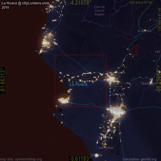
Analysis of La Huaca night lights 2016
Square area 10x10 km:
 0.41%
0.41%90-99
0.41%80-89
3.51%70-79
1.03%60-69
0%50-59
1.03%40-49
2.69%30-39
2.07%20-29
3.31%10-19
1.45%0-9
84.09%Square area 50x50 km:
0.33%90-99
0.37%80-89
2.01%70-79
0.56%60-69
0.22%50-59
0.48%40-49
0.75%30-39
1.04%20-29
1.26%10-19
4.36%0-9
88.63%Clear (daylight) street map image can be seen on geolist.org.
Map coordinates:
4° 12' 38.8" South, 81° 39' 47.3" West
4° 54' 42" South, 80° 57' 36" West
5° 36' 42.6" South, 80° 15' 24.8" West
Some cities around La Huaca sort by population:
• Piura
48 km =29.8 mi,  130°
130°
• Sullana
30.4 km =18.9 mi,  88°
88°
• Catacaos
50 km =31.1 mi,  142°
142°
• Paita
26.1 km =16.2 mi,  220°
220°
• Marcavelica
28.5 km =17.7 mi,  82°
82°
• Querecotillo
35.8 km =22.2 mi, 76°
• Salinera Colán
18 km =11.2 mi, 221°
• Salitral
31.5 km =19.6 mi, 78°
3695829 (p: 8,468)
Sources (retrieved 2019-11-25):
» Earth at Night: Flat Maps 2012, 2016