La Oroya night lights from space
Night Light of La Oroya (Junin) from space (Peru) Src. Average luminocity for 10x10km area is 18.0563% and for 50x50km: 3.6686%.
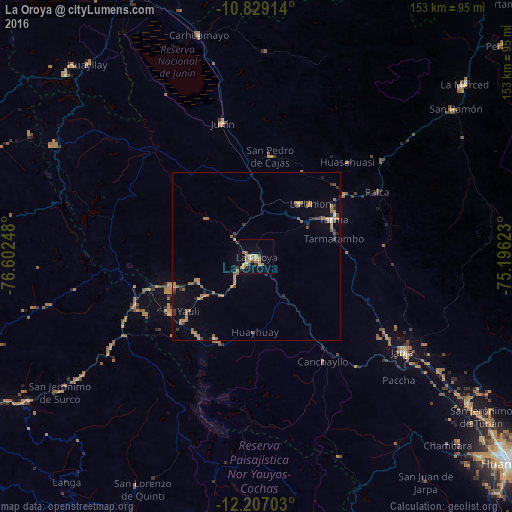
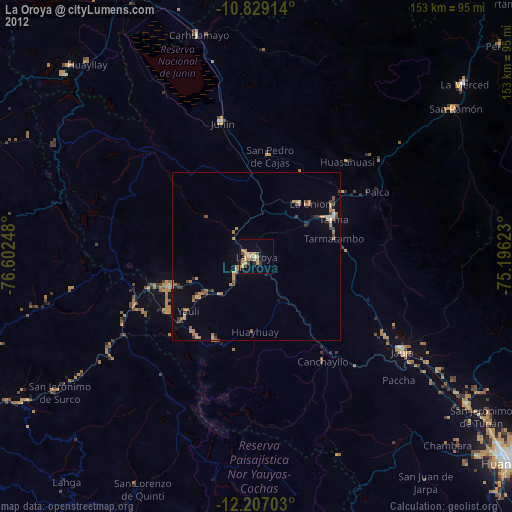
Analysis of La Oroya night lights 2016
Square area 10x10 km:
 0%
0%90-99
0.87%80-89
0.87%70-79
8.66%60-69
6.93%50-59
0.87%40-49
0.22%30-39
3.25%20-29
1.3%10-19
5.84%0-9
71.21%Square area 50x50 km:
0.07%90-99
0.1%80-89
0.09%70-79
0.94%60-69
1.33%50-59
0.63%40-49
0.45%30-39
0.52%20-29
0.62%10-19
0.98%0-9
94.28%Clear (daylight) street map image can be seen on geolist.org.
Map coordinates:
10° 49' 44.9" South, 76° 36' 8.9" West
11° 31' 8.1" South, 75° 53' 57.7" West
12° 12' 25.3" South, 75° 11' 46.4" West
Some cities around La Oroya sort by population:
• Tarma
25.4 km =15.8 mi,  64°
64°
• Jauja
52.3 km =32.5 mi,  123°
123°
• Junín
41.3 km =25.7 mi,  345°
345°
• Carhuamayo
68.5 km =42.6 mi, 347°
• Morococha
27.8 km =17.3 mi,  251°
251°
• Acolla
45.2 km =28.1 mi, 121°
• San Pedro de Cajas
30.1 km =18.7 mi,  7°
7°
• Huasahuasi
39.4 km =24.5 mi,  44°
44°
3936952 (p: 33,345)
Sources (retrieved 2019-11-25):
» Earth at Night: Flat Maps 2012, 2016