Bayt al ‘Awābī night lights from space
Night Light of Bayt al ‘Awābī (Al Batinah South) from space (Oman) Src. Average luminocity for 10x10km area is 25.3712% and for 50x50km: 10.5268%.
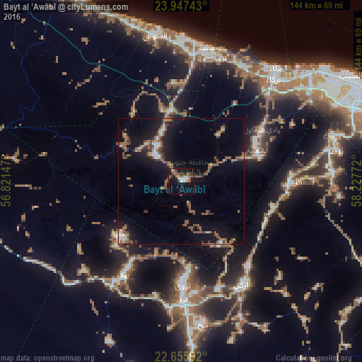
Analysis of Bayt al ‘Awābī night lights 2016
Square area 10x10 km:
 2.65%
2.65%90-99
4.17%80-89
1.52%70-79
1.89%60-69
4.36%50-59
8.33%40-49
0.38%30-39
4.17%20-29
3.41%10-19
33.14%0-9
35.98%Square area 50x50 km:
1.06%90-99
1.02%80-89
0.45%70-79
0.66%60-69
1.64%50-59
4.28%40-49
0.85%30-39
1.34%20-29
1.89%10-19
10.22%0-9
76.59%Clear (daylight) street map image can be seen on geolist.org.
Map coordinates:
23° 56' 50.7" North, 56° 49' 17.3" East
23° 18' 11.7" North, 57° 31' 28.5" East
22° 39' 21.3" North, 58° 13' 39.8" East
Some cities around Bayt al ‘Awābī sort by population:
• As Suwayq
61.4 km =38.2 mi,  351°
351°
• Barkā’
55.7 km =34.6 mi,  41°
41°
• Rustaq
14.1 km =8.8 mi,  313°
313°
• Nizwá
41.1 km =25.5 mi,  178°
178°
• Bahlā’
42.5 km =26.4 mi,  211°
211°
• Sufālat Samā’il
50.3 km =31.3 mi,  88°
88°
• Izkī
48 km =29.8 mi,  148°
148°
• Oman Smart Future City
39.6 km =24.6 mi,  11°
11°
412084 (p: 10,711)
Sources (retrieved 2019-11-25):
» Earth at Night: Flat Maps 2012, 2016