Palmerston North night lights from space
Night Light of Palmerston North (Manawatu-Wanganui) from space (New Zealand) Src. Average luminocity for 10x10km area is 47.4235% and for 50x50km: 2.9655%.
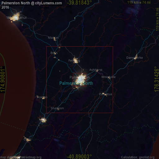
Analysis of Palmerston North night lights 2016
Square area 10x10 km:
 9.35%
9.35%90-99
14.63%80-89
7.14%70-79
3.91%60-69
3.74%50-59
2.21%40-49
3.4%30-39
7.65%20-29
11.56%10-19
28.74%0-9
7.65%Square area 50x50 km:
0.36%90-99
0.62%80-89
0.37%70-79
0.24%60-69
0.22%50-59
0.18%40-49
0.38%30-39
0.7%20-29
0.82%10-19
2.42%0-9
93.68%Clear (daylight) street map image can be seen on geolist.org.
Map coordinates:
39° 49' 6.3" South, 174° 54' 28.8" East
40° 21' 22.9" South, 175° 36' 40.1" East
40° 53' 24.1" South, 176° 18' 51.3" East
Some cities around Palmerston North sort by population:
• Porirua
107.6 km =66.9 mi,  216°
216°
• Wanganui
67 km =41.6 mi,  314°
314°
• Upper Hutt
99 km =61.5 mi,  208°
208°
• Paraparaumu
80 km =49.7 mi, 218°
• Masterton
67.2 km =41.8 mi,  176°
176°
• Levin
41.9 km =26 mi, 222°
• Otaki
59.3 km =36.8 mi, 221°
• Linton Military Camp
5.7 km =3.5 mi,  204°
204°
2185018 (p: 75,996)
Sources (retrieved 2019-11-25):
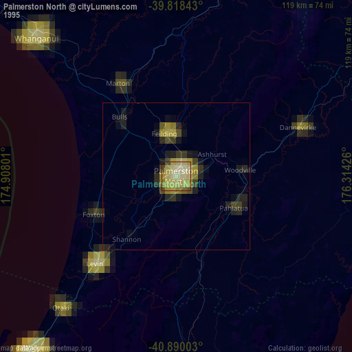
» NASA, Earths city lights 1995
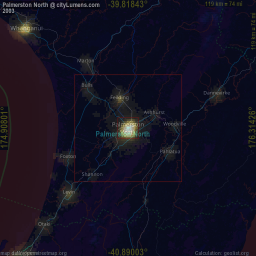
» NASA city lights 2003
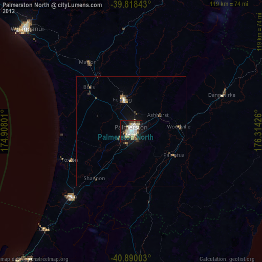
» Earth at Night: Flat Maps 2012, 2016