Levin night lights from space
Night Light of Levin (Manawatu-Wanganui) from space (New Zealand) Src. Average luminocity for 10x10km area is 10.5974% and for 50x50km: 0.7428%.
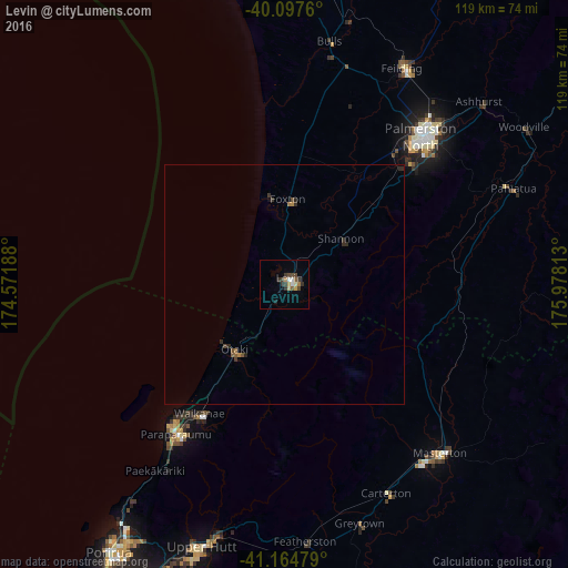
Analysis of Levin night lights 2016
Square area 10x10 km:
 0.97%
0.97%90-99
1.3%80-89
1.95%70-79
0.32%60-69
1.3%50-59
1.3%40-49
2.76%30-39
4.87%20-29
0.16%10-19
0.65%0-9
84.42%Square area 50x50 km:
0.04%90-99
0.05%80-89
0.08%70-79
0.05%60-69
0.12%50-59
0.14%40-49
0.18%30-39
0.33%20-29
0.2%10-19
0.05%0-9
98.76%Clear (daylight) street map image can be seen on geolist.org.
Map coordinates:
40° 5' 51.4" South, 174° 34' 18.8" East
40° 37' 60" South, 175° 16' 30" East
41° 9' 53.2" South, 175° 58' 41.3" East
Some cities around Levin sort by population:
• Lower Hutt
71.5 km =44.4 mi,  204°
204°
• Palmerston North
41.9 km =26 mi,  42°
42°
• Porirua
66.1 km =41.1 mi,  212°
212°
• Upper Hutt
59.2 km =36.8 mi, 198°
• Paraparaumu
38.3 km =23.8 mi, 214°
• Masterton
48.5 km =30.1 mi,  138°
138°
• Otaki
17.4 km =10.8 mi,  217°
217°
• Linton Military Camp
36.5 km =22.7 mi,  45°
45°
2206371 (p: 19,789)
Sources (retrieved 2019-11-25):
» Earth at Night: Flat Maps 2012, 2016