Napier night lights from space
Night Light of Napier (Hawke's Bay) from space (New Zealand) Src. Average luminocity for 10x10km area is 35.4805% and for 50x50km: 4.4121%.
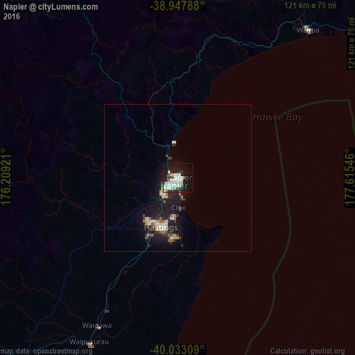

Analysis of Napier night lights 2016
Square area 10x10 km:
 4.38%
4.38%90-99
13.96%80-89
5.68%70-79
0.65%60-69
2.92%50-59
1.79%40-49
2.11%30-39
3.73%20-29
6.82%10-19
30.03%0-9
27.92%Square area 50x50 km:
0.37%90-99
1.01%80-89
0.6%70-79
0.31%60-69
0.42%50-59
0.44%40-49
0.28%30-39
0.82%20-29
0.99%10-19
5.44%0-9
89.31%Clear (daylight) street map image can be seen on geolist.org.
Map coordinates:
38° 56' 52.4" South, 176° 12' 33.2" East
39° 29' 33.4" South, 176° 54' 44.4" East
40° 1' 59.1" South, 177° 36' 55.7" East
Some cities around Napier sort by population:
• Palmerston North
146.7 km =91.2 mi,  229°
229°
• Rotorua
161.2 km =100.2 mi,  338°
338°
• Hastings
17.1 km =10.6 mi,  198°
198°
• Gisborne
132.6 km =82.4 mi,  45°
45°
• Taupo
115 km =71.5 mi,  321°
321°
• Taradale
7 km =4.3 mi, 229°
• Kawerau
155.9 km =96.9 mi,  353°
353°
• Linton Military Camp
151.9 km =94.4 mi, 228°
2186313 (p: 56,787)
Sources (retrieved 2019-11-25):
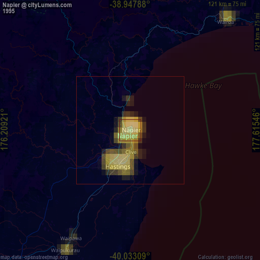
» NASA, Earths city lights 1995
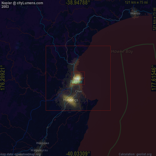
» NASA city lights 2003
» Earth at Night: Flat Maps 2012, 2016